Kontakt | RSS | EN | DE | EL | ES | FR | IT | RU

Barren Island volcano (Andaman Islands, India) - Smithsonian / USGS Weekly Volcanic Activity Report for 27 March-2 April 2024 (New Activity / Unrest)

Mi, 3. Apr 2024, 18:00 | VON: VN
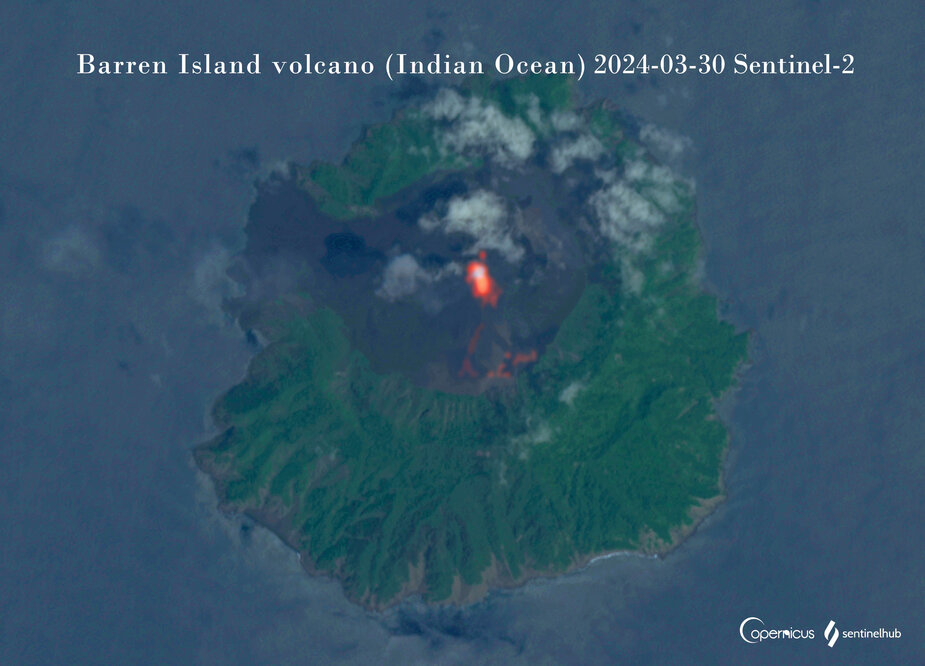
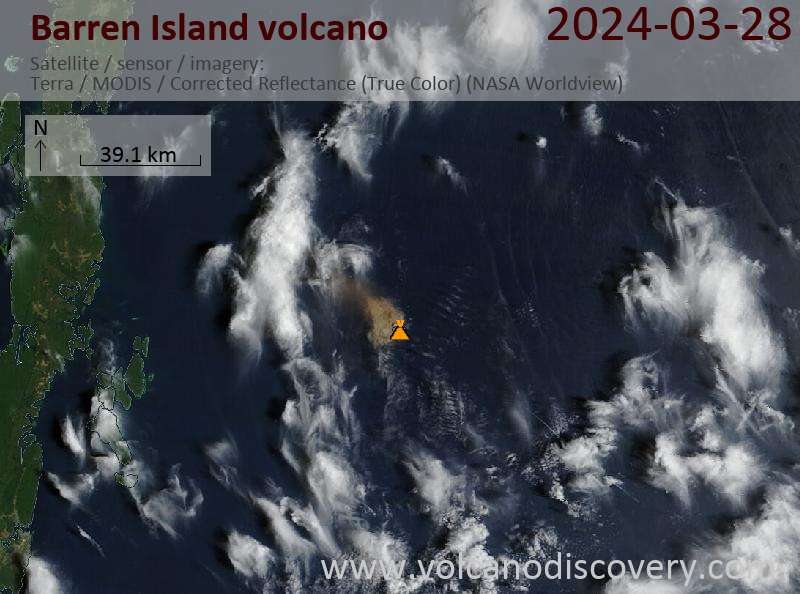
According to the Darwin VAAC eruptive activity at Barren Island produced ash plumes during 28 March-1 April. Ash plumes identified in satellite images at 1320 and 1930 on 28 March rose to 2.4 km (8,000 ft) a.s.l. and drifted NW.
A strong thermal anomaly over the summit was visible in the 1930 image. Ash dissipated within about four hours. A larger thermal anomaly was visible in a satellite image at 0410 on 31 March.
Ash plumes visible in images at 0410 and 1010 on 31 March rose to 2.4 km a.s.l. and drifted W. By 1440 ash was not visible, though weather conditions prevented views.
At 1010 on 1 April a continuous ash plume rose to 1.8 km (6,000 ft) a.s.l. and drifted S.

Source: Darwin Volcanic Ash Advisory Centre (VAAC)
---
From: Global Volcanism Program, 2024. Report on Barren Island. In: Mayberry, G (ed.), Weekly Volcanic Activity Report 27 March-2 April 2024. Smithsonian Institution and US Geological Survey.

Vorherige Nachrichten

Mehr anzeigen

Hintergrund-Info:


Die Barren Inseln befinden sich 135 km nordöstlich von Port Blair in der Andamanischen See. Die Barreninseln gehören zu Indien und sind der einzige Vulkan,d er in historischer Zeit auf dem vulkanischen Inselarchipel aktiv war, das sich zwischen Sumatra und Burma (Myanmar) erstreckt. The 354-m-high island is the emergent summit of a volcano that rises from a depth of about 2250 m. 


Auf der nur 354 m hohen Insel ist der Vulkan die einzige, auffällige Erhebung, die aber in einer Meerestiefe von 2250 m beginnt. The small, uninhabited 3-km-wide island contains a roughly 2-km-wide caldera with walls 250-350 m high. Die kleine (3km im Druchmesser), unbewohnte Insel beherbergt eime ca. 2 km weite Kaldera deren Wände 250-350 m hoch sind. Die Kaldera, die sich zur See hin öffnet, entstand während einer heftigen Eruption im Pleistozän und produzierte starke pyroklastische Glutströme und Ascheablagerungen.


Die Landschaft wird durch einen relativ frischen Vulkankegel in der Mitte der Kaldera beherrscht, der während historischer Eruptionen entstand. Lavaströme haben die Kaldera angefüllt und erreichten das Meer an der Westküste im 19. Jahrhundert und in den Jahren 1991 & 1995. 


---
Quelle: GVP, Smithsonian Institution


Stratovolcano 354 m / 1,161 ft.
Indian Ocean, 12.28°N / 93.86°E
Aktueller Status: Ausbruch (4 von 5) Ausbrüche des Barren Island:
1787, 1789, 1795, 1803-04, 1852(?), 1991, 1994-95, 2005-2006, 2015, 2016, 2018, 2019
Typische Aktivität
Explosive
Location map of Barren Island.
Warum gibt es Werbung auf dieser Seite?
Sources: VolcanoDiscovery / VolcanoAdventures and other sources as noted.
Use of material: Most text and images on our websites are owned by us. Re-use is generally not permitted without authorization. Contact us for licensing rights.
Volcanoes & Earthquakes
VolcanoDiscovery Home
Vulkane | Erdbeben | Fotos | News | App
Adventure & Study Travel
Reisen zu Vulkanen und Vulkangebieten: Wanderreisen, Studienreisen, Fotoreisen
Tours & Dates | FAQ | About us
Get our newsletter!
Company info
Kontakt | Impressum | AGB
Follow us
Follow us on facebook Follow us on Instagram Follow us on Twitter Visit our Youtube channel
EN | DE | EL | ES | FR | IT | RU
VolcanoDiscovery GmbH, Germany, Reg. nr.: HRB 103744, EU Tax Id: DE 297 465 123 owned and created by
Dr. Tom Pfeiffer, volcanologist, volcano photographer, tour organizer member of
IAVCEI
IAVCEI
Vulkanologische Gesellschaft
Volcanological Society
Ecotourism Greece
Ecotourism Greece
RUV insurance
Insured by R+V
VolcanoDiscovery © 2004- All Rights Reserved | Datenschutz - Cookie Einstellungen