Contact | RSS | EN | DE | EL | ES | FR | IT | RU
Event status: highly uncertain [?]

Reported quake or seismic-like event: Near Mexico, Ciudad De México, Mexico, Wednesday, Nov 15, 2023, at 02:50 pm (Mexico City time) -

A possible earthquake might have occurred near Mexico, Mexico D.F.,  Mexico, in the early afternoon of Wednesday, Nov 15, 2023 at around 2.50 pm local time (America/Mexico City GMT -6). Details of the quake (if it is one) are so far unkown until confirmed by a seismic agency, but the event was reported felt. We will update the status of the event on this page as soon as more information becomes available. Reported quake or seismic-like event: Near Mexico, Ciudad De México, Mexico, Wednesday, Nov 15, 2023, at 02:50 pm (Mexico City time) Reported quake or seismic-like event: Near Mexico, Ciudad De México, Mexico, Wednesday, Nov 15, 2023, at 02:50 pm (Mexico City time)
15 Nov 20:56 UTC: First to report: VolcanoDiscovery after 5 minutes.

Earthquake details

Date & timeNov 15, 2023 20:50:47 UTC -
Local time at epicenterWednesday, Nov 15, 2023, at 02:50 pm (America/Mexico City GMT -6)
Statushighly uncertain
Magnitudeunknown (3.8?)
Depth20 km
Epicenter latitude / longitude19.2871°N / 99.1126°W Xochimilco, Mexico D.F., Mexico
Seismic antipode19.2871°S / 80.8874°E
Shaking intensityIII Weak shaking near epicenter
Felt1 report
Primary data sourceVolcanoDiscovery (User-reported shaking)
Nearest volcanoChichinautzin (28 km / 17 mi)
Weather at epicenter at time of quakeClear Sky 22.7°C (73 F), humidity: 31%, wind: 3 m/s (5 kts) from NNE
[smaller] [bigger]

Nearby places

The closest larger town where the quake might have been felt is Mexico, the capital of  Mexico with 12,000,000 inhabitants, in 15.8 km (10 mi) distance north of the epicenter. People likely experienced weak shaking there. Many smaller towns and villages are located closer to the epicenter and might have experienced stronger shaking.
The following table shows some of the places that might have been affected (or not) by the shaking.
Distance Place Max. shaking intensity(*) Region Country
4 km (2 mi)
S of epicenter
Xochimilco
(pop: 407,900)
III: Weak
Mexico D.F.
5 km (3 mi)
W of epicenter
Tlalpan
(pop: 574,600)
III: Weak
Mexico D.F.
8 km (5 mi)
NW of epicenter
Coyoacan
(pop: 620,400)
III: Weak
Coyoacan, Mexico D.F.
9 km (6 mi)
NE of epicenter
Iztapalapa
(pop: 1,815,800)
III: Weak
Mexico D.F.
10 km (6 mi)
S of epicenter
San Miguel Topilejo
(pop: 34,600)
III: Weak
Tlalpan, Mexico D.F.
11 km (7 mi)
E of epicenter
Tlahuac
(pop: 305,100)
III: Weak
Tlahuac, Mexico D.F.
11 km (7 mi)
NW of epicenter
Magdalena Contreras
(pop: 238,400)
III: Weak
Mexico D.F.
12 km (7 mi)
S of epicenter
San Pablo Oztotepec
(pop: 15,500)
III: Weak
Milpa Alta, Mexico D.F.
12 km (8 mi)
N of epicenter
Iztacalco
(pop: 384,300)
III: Weak
Mexico D.F.
13 km (8 mi)
N of epicenter
Benito Juarez
(pop: 355,000)
III: Weak
Benito Juarez, Mexico D.F.
13 km (8 mi)
SE of epicenter
San Juan Ixtayopan
(pop: 24,100)
III: Weak
Tlahuac, Mexico D.F.
14 km (9 mi)
SE of epicenter
Milpa Alta
(pop: 18,300)
III: Weak
Mexico D.F.
15 km (9 mi)
SE of epicenter
San Antonio Tecomitl
(pop: 24,400)
III: Weak
Milpa Alta, Mexico D.F.
16 km (10 mi)
NE of epicenter
Emiliano Zapata
(pop: 25,300)
III: Weak
La Paz, Mexico
16 km (10 mi)
N of epicenter
Mexico
(pop: 12,294,200)
III: Weak
Mexico D.F.
16 km (10 mi)
NE of epicenter
Ciudad Nezahualcoyotl
(pop: 1,104,600)
III: Weak
Nezahualcoyotl, Mexico
17 km (10 mi)
NE of epicenter
Los Reyes Acaquilpan
(pop: 85,400)
III: Weak
La Paz, Mexico
17 km (11 mi)
E of epicenter
San Miguel Xico
(pop: 356,400)
III: Weak
Valle de Chalco Solidaridad, Mexico
18 km (11 mi)
N of epicenter
Cuauhtémoc
(pop: 531,800)
III: Weak
Mexico D.F.
18 km (11 mi)
E of epicenter
San Isidro
(pop: 33,700)
III: Weak
La Paz, Mexico
19 km (12 mi)
NW of epicenter
Miguel Hidalgo
(pop: 372,900)
III: Weak
Mexico D.F.
19 km (12 mi)
NW of epicenter
Col. Bosques de las Lomas
(pop: 15,000)
III: Weak
Cuajimalpa de Morelos, Mexico D.F.
21 km (13 mi)
NW of epicenter
Delegacion Cuajimalpa de Morelos
(pop: 160,500)
III: Weak
Cuajimalpa de Morelos, Mexico D.F.
23 km (14 mi)
NE of epicenter
Santa Maria Chimalhuacan
(pop: 612,400)
III: Weak
Chimalhuacan, Mexico
23 km (14 mi)
E of epicenter
Chalco
(pop: 168,700)
III: Weak
Mexico
23 km (14 mi)
N of epicenter
Gustavo Adolfo Madero
(pop: 1,185,800)
III: Weak
Gustavo A. Madero, Mexico D.F.
24 km (15 mi)
N of epicenter
Azcapotzalco
(pop: 414,700)
III: Weak
Mexico D.F.
24 km (15 mi)
E of epicenter
Ixtapaluca
(pop: 322,300)
III: Weak
Mexico
25 km (16 mi)
NW of epicenter
Naucalpan de Juarez
(pop: 792,200)
III: Weak
Naucalpan de Juarez, Mexico
26 km (16 mi)
W of epicenter
Huixquilucan
(pop: 124,800)
III: Weak
Mexico
26 km (16 mi)
NE of epicenter
Chicoloapan
(pop: 172,900)
III: Weak
Mexico
29 km (18 mi)
N of epicenter
Tlalnepantla de Comonfort
(pop: 653,400)
III: Weak
Tlalnepantla de Bas, Mexico
34 km (21 mi)
NW of epicenter
Ciudad Lopez Mateos
(pop: 489,200)
III: Weak
Atizapan de Zaragoza, Mexico
35 km (22 mi)
NE of epicenter
Texcoco
(pop: 105,200)
III: Weak
Mexico
36 km (22 mi)
N of epicenter
San Cristobal
(pop: 1,655,000)
III: Weak
Ecatepec de Morelos, Mexico
36 km (23 mi)
N of epicenter
Buenavista
(pop: 206,100)
III: Weak
Tultitlan, Mexico
38 km (24 mi)
N of epicenter
Coacalco
(pop: 278,000)
III: Weak
Mexico
41 km (25 mi)
NE of epicenter
Tepexpan
(pop: 102,700)
III: Weak
Acolman de Nezahualcoyotl, Mexico
41 km (26 mi)
N of epicenter
San Francisco Tepoiaco
(pop: 484,600)
II: Very weak
Cuautitlan Izcalli, Mexico
Notes:
(*) Shaking intensity according to the Modified Mercalli Intensity Scale (MMI) and estimated using seismic models.

User-reports for this possible quake (1)

The first report about ground shaking reached us after only 5 minutes. We received 1 report for this unconfirmed quake.
User reports estimate the perceived ground shaking intensity according to the MMI (Modified Mercalli Intensity) scale.
Contribute:
Leave a comment if you find a particular report interesting or want to add to it.
Flag as inappropriate.
Mark as helpful or interesting.
Send your own user report!
Translate
Mexico City / Weak shaking (MMI III) : My car shaked  
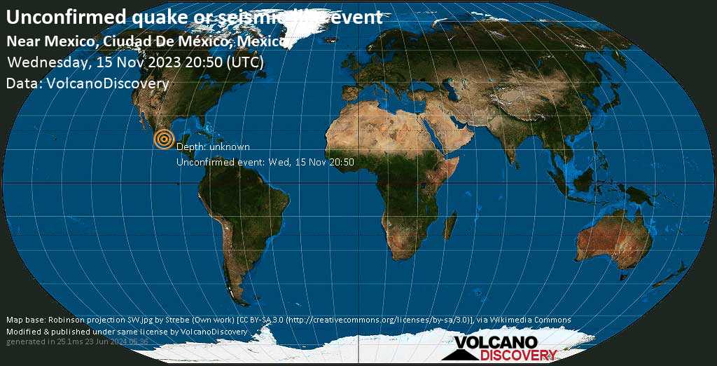
What is Intensity and the Mercalli Intensity Scale?


The amount of shaking that occurs on the surface due to an earthquake is called the intensity. It is commonly measured on the so-called Modified Mercalli Intensity Scale (MMI) ranging from 1 (not felt) to 10 (extreme shaking), and given in Roman numerals as I,II,...IX, X, and often displayed with color codes ranging from light blue to dark red.
Earthquake intensity depends mainly on the magnitude and depth of the quake as well as the distance from the epicenter: The further away, the less shaking intensity occurs.
Read more about the MMI scale!

Compare Quake Data

Data for the same earthquake as reported by different agencies

The more agencies report about the same quake and post similar data, the more confidence you can have in the data. It takes normally up to a few hours until earthquake parameters are calculated with near-optimum precision.
Mag Depth Time GMT
2023-11-15
Epicenter Agency
3.8 20 km
12 mi
20:50:47 Near Mexico, Ciudad De México, Mexico VolcanoDiscovery (User-reported shaking)

Seismograms

Seismic station: Unam - Mexico, Mexico (UNM/G network) | Distance from quake: 8 km / 5 mi | Show on map | Station Info
Seismic station Unam - Mexico, Mexico: vertical movement plot around time of quake (source: IRIS/BUD)
Seismogram (vertical component) around time of quake. Thin dotted red line indicates time of quake. Seismic waves arrive some time later, depending on distance. Bandpass filter applied: 0.5-10.0 Hz. Source: IRIS Buffer of Uniform Data (BUD) webtool
Show more

Earthquake statistics

Average number of earthquakes

Based on data from the past 54 years and our earthquake archive back to 1900, there are about 53 quakes on average per year in the area near the epicenter of this quake (within 100 km/61 mi):
  • Mag. 6 or higher: 0.02 quakes per year (or 1 quake every 62.5 years)
  • Mag. 5 or higher: 0.02 quakes per year (or 1 quake every 62.5 years)
  • Mag. 4 or higher: 0.33 quakes per year (or 1 quake every 3.1 years)
  • Mag. 3 or higher: 25.8 quakes per year
  • Mag. 2 or higher: 39.3 quakes per year (or 3.3 quakes per month)
  • Mag. 1 or higher: 53 quakes per year (or 4.4 quakes per month)
The area where this quake occurred has a high level of seismic activity. It has had at least 2 quakes above magnitude 6 since 1900, which suggests that larger earthquakes of this size occur infrequently, probably on average approximately every 60 to 65 years.

Number of quakes per year

Previous quakes in the same area of this earthquake

Map of earlier quakes in the area of this quake

[smaller] [bigger]

Map to embed or share

Why is there advertising on this site?
Sources: VolcanoDiscovery / VolcanoAdventures and other sources as noted.
Use of material: Most text and images on our websites are owned by us. Re-use is generally not permitted without authorization. Contact us for licensing rights.
Volcanoes & Earthquakes
VolcanoDiscovery Home
Volcanoes | Earthquakes | Photos | Volcano News | App
Adventure & Study Travel
Tours to Volcanoes and Volcanic Areas: walking tours, photo tours, study tours
Tours & Dates | FAQ | About us
Get our newsletter!
Company info
Contact | Legal info | Terms & conditions
Follow us
Follow us on facebook Follow us on Instagram Follow us on Twitter Visit our Youtube channel
EN | DE | EL | ES | FR | IT | RU
VolcanoDiscovery GmbH, Germany, Reg. nr.: HRB 103744, EU Tax Id: DE 297 465 123 owned and created by
Dr. Tom Pfeiffer, volcanologist, volcano photographer, tour organizer member of
IAVCEI
IAVCEI
Vulkanologische Gesellschaft
Volcanological Society
Ecotourism Greece
Ecotourism Greece
RUV insurance
Insured by R+V
VolcanoDiscovery © 2004- All Rights Reserved | Privacy - Cookie Settings
Cookie-free, privacy-friendly web stats