Contact | RSS | EN | DE | EL | ES | FR | IT | RU

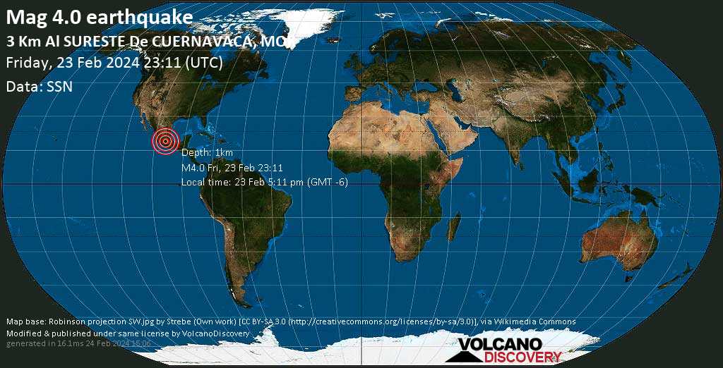
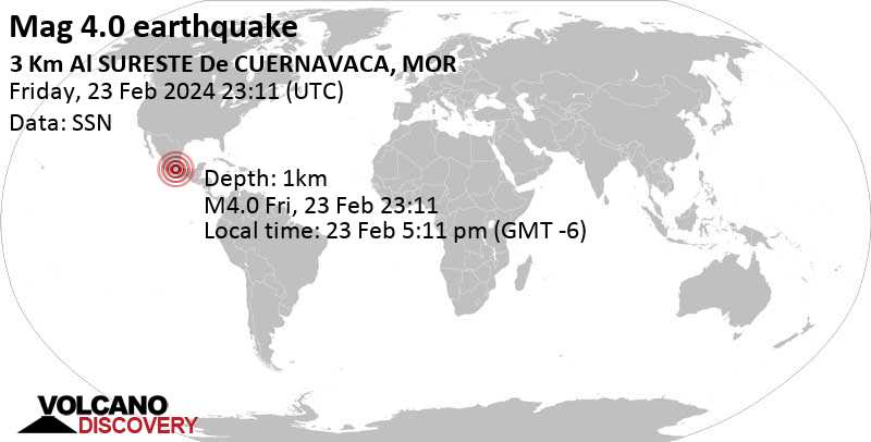
Mag. 4.0 earthquake - 2.8 km southeast of Cuernavaca, Morelos, Mexico, on Friday, Feb 23, 2024, at 05:11 pm (Mexico City time) -

A moderate magnitude 4.0 earthquake hit 2.8 km (1.8 mi) away from Cuernavaca, Morelos,  Mexico, in the afternoon of Friday, Feb 23, 2024 at 5.11 pm local time (America/Mexico City GMT -6). The quake had a very shallow depth of 1 km (0.6 mi) and was felt widely in the area. The shallow depth of the quake caused it to be felt more strongly near the epicenter than a deeper quake of similar magnitude would.

Mag. 4.0 earthquake - 2.8 km southeast of Cuernavaca, Morelos, Mexico, on Friday, Feb 23, 2024, at 05:11 pm (Mexico City time) Mag. 4.0 earthquake - 2.8 km southeast of Cuernavaca, Morelos, Mexico, on Friday, Feb 23, 2024, at 05:11 pm (Mexico City time)
Moderate magnitude 4.0 earthquake at 1 km depth
23 Feb 23:13 UTC: First to report: VolcanoDiscovery after 3 minutes.
23 Feb 23:28: Now using data updates from SSN
23 Feb 23:42: Hypocenter depth recalculated from 5.0 to 1.0 km (from 3.1 to 0.6 mi).
Update Fri, 23 Feb 2024, 23:30

Moderate tremor of magnitude 4.0 just reported 3 km southeast of Cuernavaca, Mexico

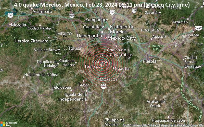
4.0 quake Morelos, Mexico, Feb 23, 2024 05:11 pm (Mexico City time)
Just 19 minutes ago, a 4.0-magnitude earthquake struck near Cuernavaca, Morelos, Mexico. The tremor was recorded in the afternoon on Friday, February 23rd, 2024, at 5:11 pm local time, at a very shallow depth of 5 km below the surface.
The event was filed by Mexico's National Seismological Service (SSN), the first seismological agency to report it.
A second report was later issued by the European-Mediterranean Seismological Centre (EMSC), which listed it as a magnitude 4.0 earthquake as well.
Based on the preliminary seismic data, the quake was probably felt by many people in the area of the epicenter. It should not have caused significant damage, other than objects falling from shelves, broken windows, etc.
In Cuernavaca (pop. 338,700) located 3 km from the epicenter, Tres de Mayo (pop. 18,000) 5 km away, Jiutepec (pop. 162,400) 5 km away, Temixco (pop. 97,800) 7 km away, and Emiliano Zapata (pop. 49,200) 8 km away, the quake should have been felt as light shaking.
Weak shaking might have been felt in Xochitepec (pop. 19,200) located 15 km from the epicenter, Yautepec (pop. 42,700) 15 km away, and Cuautla (pop. 154,400) 31 km away.
Other towns or cities near the epicenter where the quake might have been felt as very weak shaking include Iztapalapa (pop. 1,815,800) located 52 km from the epicenter, and Mexico (pop. 12,294,200) 58 km away.
Update Fri, 23 Feb 2024, 23:16

Seismic-like event, possible earthquake, reported few minutes ago near Cuernavaca, Morelos, Mexico

We are receiving unverified early reports of ground shaking possibly caused by seismic activity in or near Cuernavaca, Morelos, Mexico on 23 Feb 2024 (GMT) at approximately 23:10 GMT.
There are no details yet on the magnitude or depth of this possible quake. If confirmed, we can expect more accurate data to emerge in the next few minutes. The location, magnitude and time mentioned are indicative, based on our best-fit seismic model. They are temporary until our AllQuakes monitoring service receives more exact scientific data from a national or international seismological agency. Check back here shortly and stay safe.
Download the Volcanoes & Earthquakes app and get one of the fastest seismic alerts online: Android | iOS

Earthquake details

Date & timeFeb 23, 2024 23:11:00 UTC -
Local time at epicenterFriday, Feb 23, 2024, at 05:11 pm (America/Mexico City GMT -6)
StatusPreliminary (automatic detection)
Magnitude4.0
Depth1 km
Epicenter latitude / longitude18.91°N / 99.21°W Cuernavaca, Morelos, Mexico
Seismic antipode18.91°S / 80.79°E
Shaking intensityV Moderate shaking near epicenter
Felt38 reports
Primary data sourceSSN (Servicio Sismológico Nacional)
Nearest volcanoChichinautzin (21 km / 13 mi)
Weather at epicenter at time of quakeClear Sky 31.8°C (89 F), humidity: 15%, wind: 2 m/s (3 kts) from SE
Estimated seismic energy released6.3 x 1010 joules (17.5 megawatt hours, equivalent to 15.1 tons of TNT) | about seismic energy
[smaller] [bigger]

Nearby places

The closest larger town where the quake might have been felt is Mexico, the capital of  Mexico with 12,000,000 inhabitants, in 58 km (36 mi) distance north of the epicenter. People likely experienced weak shaking there. Many smaller towns and villages are located closer to the epicenter and might have experienced stronger shaking.
The following table shows some of the places that might have been affected (or not) by the shaking.
Distance Place Max. shaking intensity(*) Region Country
3 km (2 mi)
NW of epicenter
Cuernavaca
(pop: 338,700)
V: Moderate
Morelos
5 km (3 mi)
S of epicenter
Tres de Mayo
(pop: 18,000)
V: Moderate
Emiliano Zapata, Morelos
5 km (3 mi)
SE of epicenter
Jiutepec
(pop: 162,400)
V: Moderate
Morelos
7 km (4 mi)
S of epicenter
Temixco
(pop: 97,800)
IV: Light
Morelos
7 km (4 mi)
SE of epicenter
Progreso
(pop: 14,500)
IV: Light
Jiutepec, Morelos
8 km (5 mi)
S of epicenter
Emiliano Zapata
(pop: 49,200)
IV: Light
Morelos
9 km (6 mi)
E of epicenter
La Joya
(pop: 13,700)
IV: Light
Morelos
15 km (9 mi)
S of epicenter
Xochitepec
(pop: 19,200)
IV: Light
Morelos
15 km (10 mi)
E of epicenter
Yautepec
(pop: 42,700)
IV: Light
Morelos
23 km (15 mi)
S of epicenter
Santa Rosa Treinta
(pop: 16,700)
III: Weak
Tlaltizapan de Zapata, Morelos
25 km (16 mi)
S of epicenter
Xoxocotla
(pop: 21,100)
III: Weak
Puente de Ixtla, Morelos
29 km (18 mi)
S of epicenter
Zacatepec de Hidalgo
(pop: 21,600)
III: Weak
Zacatepec, Morelos
31 km (19 mi)
E of epicenter
Cuautla
(pop: 154,400)
III: Weak
Morelos
31 km (19 mi)
S of epicenter
Tlaquiltenango
(pop: 18,300)
III: Weak
Morelos
33 km (21 mi)
S of epicenter
Jojutla
(pop: 18,900)
III: Weak
Morelos
33 km (21 mi)
N of epicenter
San Miguel Topilejo
(pop: 34,600)
III: Weak
Tlalpan, Mexico D.F.
34 km (21 mi)
NE of epicenter
San Pablo Oztotepec
(pop: 15,500)
III: Weak
Milpa Alta, Mexico D.F.
35 km (22 mi)
S of epicenter
Puente de Ixtla
(pop: 21,100)
III: Weak
Morelos
36 km (23 mi)
E of epicenter
Yecapixtla
(pop: 16,800)
III: Weak
Morelos
37 km (23 mi)
NE of epicenter
Milpa Alta
(pop: 18,300)
III: Weak
Mexico D.F.
40 km (25 mi)
N of epicenter
Xochimilco
(pop: 407,900)
III: Weak
Mexico D.F.
41 km (26 mi)
NE of epicenter
San Antonio Tecomitl
(pop: 24,400)
III: Weak
Milpa Alta, Mexico D.F.
42 km (26 mi)
NE of epicenter
San Juan Ixtayopan
(pop: 24,100)
III: Weak
Tlahuac, Mexico D.F.
43 km (27 mi)
N of epicenter
Tlalpan
(pop: 574,600)
III: Weak
Mexico D.F.
47 km (29 mi)
N of epicenter
Magdalena Contreras
(pop: 238,400)
III: Weak
Mexico D.F.
47 km (29 mi)
NE of epicenter
Tlahuac
(pop: 305,100)
III: Weak
Tlahuac, Mexico D.F.
48 km (30 mi)
NE of epicenter
San Miguel Xico
(pop: 356,400)
III: Weak
Valle de Chalco Solidaridad, Mexico
49 km (30 mi)
N of epicenter
Coyoacan
(pop: 620,400)
III: Weak
Coyoacan, Mexico D.F.
51 km (32 mi)
NE of epicenter
Chalco
(pop: 168,700)
III: Weak
Mexico
52 km (32 mi)
N of epicenter
Delegacion Cuajimalpa de Morelos
(pop: 160,500)
III: Weak
Cuajimalpa de Morelos, Mexico D.F.
52 km (32 mi)
N of epicenter
Iztapalapa
(pop: 1,815,800)
III: Weak
Mexico D.F.
52 km (32 mi)
N of epicenter
Huixquilucan
(pop: 124,800)
III: Weak
Mexico
55 km (34 mi)
N of epicenter
Benito Juarez
(pop: 355,000)
III: Weak
Benito Juarez, Mexico D.F.
55 km (34 mi)
N of epicenter
Iztacalco
(pop: 384,300)
III: Weak
Mexico D.F.
56 km (35 mi)
NE of epicenter
Los Reyes Acaquilpan
(pop: 85,400)
III: Weak
La Paz, Mexico
57 km (35 mi)
NE of epicenter
Ixtapaluca
(pop: 322,300)
III: Weak
Mexico
58 km (36 mi)
N of epicenter
Ciudad Nezahualcoyotl
(pop: 1,104,600)
III: Weak
Nezahualcoyotl, Mexico
58 km (36 mi)
N of epicenter
Miguel Hidalgo
(pop: 372,900)
III: Weak
Mexico D.F.
58 km (36 mi)
N of epicenter
Mexico
(pop: 12,294,200)
III: Weak
Mexico D.F.
60 km (37 mi)
N of epicenter
Cuauhtémoc
(pop: 531,800)
II: Very weak
Mexico D.F.
Notes:
(*) Shaking intensity according to the Modified Mercalli Intensity Scale (MMI) and estimated using seismic models.

User-reports for this quake (38)

The first report about ground shaking reached us after only 3 minutes, before other agencies reported it. We received 38 reports for this quake from  Mexico and  United States. The quake was reported to have been felt in up to approx. 16.7–60 km (10.4–37 mi) distance.


The majority of reports came from Cuernavaca (26 reports), a city with more than 340,000 inhabitants in Morelos in 2.8 km (1.8 mi) distance northwest of the epicenter, Mexico, Fraccionamiento Lomas de Ahuatlan (2 reports), a town with 9,000 inhabitants in 7 km (4.4 mi) distance northwest of the epicenter, and Jiutepec (2 reports) (4.6 km or 2.9 mi to the southeast). See the list of places where most people reported this quake further below.
User reports estimate the perceived ground shaking intensity according to the MMI (Modified Mercalli Intensity) scale.
Contribute:
Leave a comment if you find a particular report interesting or want to add to it.
Flag as inappropriate.
Mark as helpful or interesting.
Send your own user report!
Translate
Cuernavaca, Morelos (6.6 km NNW of epicenter) [Map] / Light shaking (MMI IV) / rattling, vibrating / 2-5 s : Se sintió una vibración muy rápida pero muy fuerte. Fue instantáneo pero vibró todas las casas | 2 users found this interesting.  
Lomas de Tzompantle (4.1 km NW of epicenter) [Map] / Moderate shaking (MMI V) / 2-5 s : Miedo, porque lo sentí intenso y corto | 2 users found this interesting.  
Catalina, Az (1904.6 km NW of epicenter) [Map] / Weak shaking (MMI III) : Tremor working up in intensity from under the earth. Heard another which came from the south east direction shortly after.  
Monte Casino, Morelos (12.6 km NNW of epicenter) [Map] / Weak shaking (MMI III) / single lateral shake / 2-5 s : I was napping when a loud snap sound woke me. It felt like someone grabbed the footboard and shook the bed back and forth about 4 times. That’s it. No rolling motion just a medium shaking.  
Cuernavaca Morelos (370.4 km NW of epicenter) [Map] / Moderate shaking (MMI V) : I was working in the computer. It was strong enough to make me tjink that I should go outside of the house.  
Cuernavaca (4.5 km WNW of epicenter) [Map] / Light shaking (MMI IV) / single lateral shake / 1-2 s : Todas las personas nos encontrábamos en el 5to piso | One user found this interesting.  
Cuernavaca Morelos (3.3 km NW of epicenter) [Map] / Very weak shaking (MMI II) / vertical swinging (up and down) / 1-2 s : Fue un jalón hacia abajo y se sintió en todo Cuernavaca | One user found this interesting.  
Cuernava, Morelos (2.1 km NW of epicenter) [Map] / Weak shaking (MMI III) / rattling, vibrating / 5-10 s : I felt the building shake a little.  
Cuernavaca (57.6 km N of epicenter) [Map] / Light shaking (MMI IV) / rattling, vibrating / 5-10 s : Few seconds light shaking  
Cuernavaca (5.8 km NW of epicenter) [Map] / Light shaking (MMI IV) / rattling, vibrating / very short
cuernavaca (61 km N of epicenter) [Map] / Light shaking (MMI IV)
Santa Monica, Ocuilan, México (24.8 km WNW of epicenter) [Map] / Moderate shaking (MMI V) : House shook from the ground up. Items on table moved  
En mi casa (6.8 km SSW of epicenter) [Map] / Moderate shaking (MMI V) : Windows might crack  
Santa María Ahuacatitlán Cuernavaca Morelos (4.6 km NNW of epicenter) [Map] / Weak shaking (MMI III) / rattling, vibrating / 2-5 s
Cuernavaca, Morelos (59.9 km N of epicenter) [Map] / Moderate shaking (MMI V) / vertical swinging (up and down) / 5-10 s
México (9 km NNW of epicenter) [Map] / Light shaking (MMI IV) / rattling, vibrating / 2-5 s : Cuernavaca  
CUERNAVACA, Morelos, México (5.2 km NW of epicenter) [Map] / Very weak shaking (MMI II) / 1-2 s
Cuernavaca, Morelos, México (4.3 km N of epicenter) [Map] / Weak shaking (MMI III) / vertical swinging (up and down) / 2-5 s
Cuernavaca morelos san cristobal (5.7 km NNW of epicenter) [Map] / Moderate shaking (MMI V) / single vertical bump / 2-5 s : Strong  
Cuernavaca, Morelos (3.6 km NNW of epicenter) [Map] / Weak shaking (MMI III) / rattling, vibrating / 5-10 s
Colonia los Cerritos, Cuernavaca, Morelos (4.5 km NNE of epicenter) [Map] / Weak shaking (MMI III) : I saw the tv and couch moving  
Cuernavaca morelos (7.6 km NW of epicenter) [Map] / Light shaking (MMI IV)
Cuernavaca, Morelos (3.2 km NNW of epicenter) [Map] / Light shaking (MMI IV)
Cuernavaca, Morelos (4.5 km NW of epicenter) [Map] / Moderate shaking (MMI V) / single vertical bump / 15-20 s
Cuernavaca, Mexico (4.1 km NW of epicenter) [Map] / Weak shaking (MMI III) / rattling, vibrating / 1-2 s
Cuernavaca (7.8 km NNE of epicenter) [Map] / Weak shaking (MMI III) / rattling, vibrating / very short
calzada de los reyes (4.1 km NW of epicenter) [Map] / Weak shaking (MMI III) / rattling, vibrating / 2-5 s
62270 (4.3 km N of epicenter) [Map] / Weak shaking (MMI III) / single vertical bump / 1-2 s
Cuernavaca (0.7 km E of epicenter) [Map] / Very weak shaking (MMI II) / single lateral shake / very short : The bed moved  
Cuernavaca (7.8 km NW of epicenter) [Map] / Light shaking (MMI IV) / rattling, vibrating / 2-5 s
av cuauhtemoc 45 (2.2 km NW of epicenter) [Map] / Very weak shaking (MMI II) / single lateral shake / very short : barely felt it shake once  
Show more
Show more

List of cities/places with most reports

PlaceDistance from epicenterAverage reported Shaking IntensityNr. of reports
Cuernavaca, Morelos, Mexico
(Pop.: 338,650)
2.8 km (1.8 mi)
NW of epicenter
III: Weak shaking26
Fraccionamiento Lomas de Ahuatlan, Morelos, Mexico
(Pop.: 8,990)
7 km (4.4 mi)
NW of epicenter
III: Weak shaking2
Jiutepec, Morelos, Mexico
(Pop.: 162,427)
4.6 km (2.9 mi)
SE of epicenter
III: Weak shaking2
Mexico, Mexico D.F., Mexico
(Pop.: 12,294,193)
58 km (36 mi)
N of epicenter
V: Moderate shaking2
Torreon, Guanajuato, Mexico
(Pop.: 1,149)
370 km (230 mi)
NW of epicenter
V: Moderate shaking1
Colonia los Cerritos, Morelos, Mexico
(Pop.: 1,068)
5.2 km (3.2 mi)
N of epicenter
III: Weak shaking1
Temixco, Morelos, Mexico
(Pop.: 97,788)
6.6 km (4.1 mi)
S of epicenter
V: Moderate shaking1
Santa Monica, Mexico, Mexico
(Pop.: 2,872)
24 km (15 mi)
W of epicenter
V: Moderate shaking1
Cuauhtémoc, Mexico D.F., Mexico
(Pop.: 531,831)
60 km (37 mi)
N of epicenter
IV: Light shaking1
Casas Adobes, Arizona, United States
(Pop.: 66,795)
1,900 km (1,181 mi)
NW of epicenter
III: Weak shaking1
Note: Only reports with latitude/longitude coordinate positions given (38 in total) could be used for statistics.

What is Intensity and the Mercalli Intensity Scale?


The amount of shaking that occurs on the surface due to an earthquake is called the intensity. It is commonly measured on the so-called Modified Mercalli Intensity Scale (MMI) ranging from 1 (not felt) to 10 (extreme shaking), and given in Roman numerals as I,II,...IX, X, and often displayed with color codes ranging from light blue to dark red.
Earthquake intensity depends mainly on the magnitude and depth of the quake as well as the distance from the epicenter: The further away, the less shaking intensity occurs.
Read more about the MMI scale!

Number of reports by intensity

Shaking intensityNumber of reportsMin-Max distance from epicenter (*)Average distance (*)
II: Very weak shaking50.7–5.2 km (0.4–3.2 mi)2.4 km (1.5 mi)
III: Weak shaking150.7–12.6 km (0.4–7.8 mi)4.3 km (2.7 mi)
IV: Light shaking103.2–61 km (2–38 mi)16.7 km (10 mi)
V: Moderate shaking54.1–25 km (2.6–15.4 mi)9.2 km (5.7 mi)
Notes
(*) Reports are filtered to exclude those that are likely highly inaccurate or esaggerated.
Only reports with latitude/longitude coordinate positions given (38 in total) could be used for geographic statistics.

Compare Quake Data

Data for the same earthquake as reported by different agencies

The more agencies report about the same quake and post similar data, the more confidence you can have in the data. It takes normally up to a few hours until earthquake parameters are calculated with near-optimum precision.
Mag Depth Time GMT
2024-02-23
Epicenter Agency
4.0 1 km
0.6 mi
23:11:00 3 Km Al SURESTE De CUERNAVACA, MOR SSN (Servicio Sismológico Nacional)
4.0 5 km
3.1 mi
23:11:00 Morelos, Mexico
0 km (0 mi) epicenter difference with SSN
EMSC (European-Mediterranean Seismological Centre)

Seismograms

Seismic station: Unam - Mexico, Mexico (UNM/G network) | Distance from quake: 47 km / 29 mi | Show on map | Station Info
Seismic station Unam - Mexico, Mexico: vertical movement plot around time of quake (source: IRIS/BUD)
Seismogram (vertical component) around time of quake. Thin dotted red line indicates time of quake. Seismic waves arrive some time later, depending on distance. Bandpass filter applied: 0.2-10.0 Hz. Source: IRIS Buffer of Uniform Data (BUD) webtool
Show more

Aftershocks for this quake

No aftershocks have been recorded so far. When aftershocks are detected, we will update this section.

What are aftershocks?


Larger earthquakes (above magnitude 5 or so) such as this one are usually followed by smaller ones known as aftershocks that occur in the same area during the days, weeks, months or even years after the main shock.
[More info]

What about this quake?


Based on its magnitude, the fault that was active during the quake likely ruptured beneath a surface of approx. 1 km2 (=0 sqare miles) as a first-order estimate. The length of the rupture zone thus was probably around 2 km (1 mi).
[More info]


Recorded aftershocks, latest first (0 quake)

Date and Time GMTMag
Depth
DistanceRegionDetails
Feb 23, 2024 05:11 pm (Mexico City)
14 weeks ago - felt
4.0

1 km
0 km - This quake2.8 km SE of Cuernavaca, Morelos, Mexico
Main Shock (this quake)
More

Map of aftershocks

Earthquake statistics

Average number of earthquakes

Based on data from the past 54 years and our earthquake archive back to 1900, there are about 67 quakes on average per year in the area near the epicenter of this quake (within 100 km/61 mi):
  • Mag. 6 or higher: 0.03 quakes per year (or 1 quake every 31.3 years)
  • Mag. 5 or higher: 0.14 quakes per year (or 1 quake every 7 years)
  • Mag. 4 or higher: 1.87 quakes per year
  • Mag. 3 or higher: 40 quakes per year (or 3.4 quakes per month)
  • Mag. 2 or higher: 53 quakes per year (or 4.4 quakes per month)
  • Mag. 1 or higher: 66 quakes per year (or 5.5 quakes per month)
The area where this quake occurred has a high level of seismic activity. It has had at least 4 quakes above magnitude 6 since 1900, which suggests that larger earthquakes of this size occur infrequently, probably on average approximately every 30 to 35 years.

Number of quakes per year

Previous quakes in the same area of this earthquake

The earthquake occurred 10 days after a magnitude 4.0 earthquake had hit on Tuesday, Feb 13, 2024, at 11:05 am local time (America/Mexico City GMT -6) in 86 km (54 mi) distance to the south: The largest quake near the epicenter of this quake during the 10 years before was an event of magnitude 7.2. It had occurred 10 years earlier, on Friday, Apr 18, 2014, at 08:27 am local time (America/Mexico City GMT -6) in Guerrero,  Mexico:
Mag. 7.2 earthquake 26 km southwest of La Laguna - Guerrero, Mexico - Apr 18, 2014 -
The strongest-ever (since 1900) recorded quake in this area measured magnitude 8.1. It had occurred 116 years ago earlier, on Thursday, Mar 26, 1908, at 05:03 pm local time (America/Mexico City GMT -6) in Guerrero,  Mexico: Below is a list and map of (larger or recent) quakes that had occurred near the area of the epicenter before this earthquake (within up to 100 km/61 mi distance, up to 300 km/183 mi for very large quakes above mag. 7). Filter the list to limit the number to show, by magnitude or time before.
Date and TimeMag
Depth
DistanceLocationDetailsMap
Feb 13, 11:05 am (Mexico City)
4.0

41 km
86 km (54 mi) to the S 28 km southeast of Iguala de la Independencia, Guerrero, Mexico
Info
Dec 7, 2023 02:03 pm (Mexico City)
5.7

48 km
84 km (52 mi) to the SE Mexico: 16 Km Al OESTE De CHIAUTLA DE TAPIA, PUE 100 reportsInfo
Sep 14, 2023 04:44 am (Mexico City)
4.4

60 km
89 km (56 mi) to the S Mexico: 22 Km Al SUR De CD DE HUITZUCO, GRO 4 reportsInfo
Aug 17, 2022 08:35 pm (Mexico City)
4.0

6 km
34 km (21 mi) to the E Mexico: 4 Km Al NORESTE De JUAN MORALES, MOR
Info
May 26, 2022 07:09 am (Mexico City)
4.0

44 km
80 km (50 mi) to the E Central Mexico 1 report
Info
Sep 7, 2021 08:47 pm (Mexico City)
7.1

10 km
249 km (155 mi) to the S 11 Km Al SUROESTE De ACAPULCO, GRO 405 reportsInfo
Jan 12, 2020 10:40 am (Mexico City)
4.1

52 km
79 km (49 mi) to the S Guerrero, 137 km south of Mexico City (Ciudad de México) 1 report
Info
Aug 17, 2019 10:45 am (Mexico City)
4.1

53 km
92 km (57 mi) to the S Guerrero, Mexico
Info
Nov 1, 2017 02:48 pm (Mexico City)
4.3

52 km
98 km (61 mi) to the SE PUEBLA, MEXICO 5 reportsInfo
Sep 19, 2017 01:14 pm (Mexico City)
7.1

56 km
83 km (51 mi) to the SE Central Mexico 345 reportsInfo
Dec 4, 2016 06:14 pm (Mexico City)
4.1

53 km
83 km (51 mi) to the SW GUERRERO, MEXICO
Info
Nov 10, 2016 02:23 am (Mexico City)
4.2

67 km
97 km (60 mi) to the W ESTADO DE MEXICO, MEXICO
Info
Aug 27, 2015 07:56 pm (Mexico City)
4.6

58 km
86 km (53 mi) to the S 18 km al SUR de IGUALA, GRO
Info
Dec 27, 2014 07:33 am (Mexico City)
4.2

56 km
90 km (56 mi) to the SW 4 km al NORTE de TELOLOAPAN, GRO 1 report
Info
Apr 18, 2014 08:27 am (Mexico City)
7.2

24 km
251 km (156 mi) to the SW 26 km southwest of La Laguna, Guerrero, Mexico 119 reportsInfo
Jan 7, 2014 12:09 am (Mexico City)
4.1

45 km
97 km (60 mi) to the SW 7km SW of Cocula, Mexico
Info
Jun 29, 2013 03:19 pm (Mexico City)
4.5

55 km
85 km (53 mi) to the S 13km N of Copalillo, Mexico
Info
Jun 15, 2013 11:19 pm (Mexico City)
5.8

52 km
84 km (52 mi) to the S 22km W of Jolalpan, Mexico 22 reportsInfo
Feb 23, 2013 05:44 am (Mexico City)
4.1

38 km
84 km (52 mi) to the S 16 km al SUR de CD DE HUITZUCO, GRO
Info
Jan 26, 2013 05:14 am (Mexico City)
4.1

51 km
99 km (62 mi) to the SW 28 km al SUR de IGUALA, GRO
Info
Jul 17, 2012 09:57 am (Mexico City)
4.1

79 km
72 km (45 mi) to the W 5km WSW of Ayotusco, Mexico
Info
Jul 17, 2012 09:57 am (Mexico City)
4.1

76 km
82 km (51 mi) to the SW Guerrero, Mexico
Info
Mar 20, 2012 12:02 pm (Mexico City)
7.4

20 km
288 km (179 mi) to the S Oaxaca, Mexico Info
May 26, 2005 09:56 am (Mexico City)
4.7

93 km
87 km (54 mi) to the SW Guerrero, Mexico
Info
Oct 28, 2004 03:30 pm (Mexico City)
4.7

61 km
78 km (48 mi) to the SW Guerrero, Mexico
Info
Nov 19, 2003 07:50 am (Mexico City)
5.3

90 km
83 km (52 mi) to the S Guerrero, Mexico Info
Jul 21, 2000 01:13 am (Mexico City)
5.9

80 km
63 km (39 mi) to the SE Puebla, Mexico Info
Jun 15, 1999 02:42 pm (Mexico City)
7.0

70 km
196 km (122 mi) to the E Puebla, Mexico Info
Sep 14, 1995 08:04 am (Mexico City)
7.4

23 km
246 km (153 mi) to the S Guerrero, Mexico Info
Sep 20, 1985 08:37 pm (Mexico City)
7.6

31 km
285 km (177 mi) to the SW Guerrero, Mexico Info
Jun 7, 1982 04:59 am (Mexico City)
7.0

34 km
277 km (172 mi) to the S Guerrero, Mexico Info
Mar 14, 1979 05:07 am (Mexico City)
7.6

49 km
250 km (155 mi) to the SW Guerrero, Mexico Info
Oct 4, 1978 12:56 am (Mexico City)
4.9

86 km
91 km (57 mi) to the S Guerrero, Mexico
Info
Jul 5, 1978 02:15 pm (Mexico City)
5.6

62 km
96 km (60 mi) to the SW Guerrero, Mexico Info
Mar 26, 1978 01:57 pm (Mexico City)
4.7

84 km
100 km (62 mi) to the S Guerrero, Mexico
Info
Feb 10, 1977 08:46 pm (Mexico City)
4.4

102 km
59 km (37 mi) to the S Morelos, Mexico
Info
Oct 29, 1974 06:03 pm (Mexico City)
4.6

81 km
71 km (44 mi) to the SW Guerrero, Mexico
Info
Nov 8, 1973 07:18 am (Mexico City)
5.3

71 km
100 km (62 mi) to the SW Guerrero, Mexico Info
Jul 6, 1964 02:22 am (Mexico City)
7.3

93 km
170 km (106 mi) to the SW 5.1 km southwest of San Antonio de las Liebres, Guerrero, Mexico Info
May 11, 1962 08:11 am (Mexico City)
7.0

25 km
224 km (139 mi) to the S Guerrero, Mexico Info
May 11, 1962 09:11 am (Mexico City)
7.0

25 km
224 km (139 mi) to the S 1 km SSW of Ejido Nuevo, Mexico Info
Jul 28, 1957 03:40 am (Mexico City)
7.6

38 km
207 km (128 mi) to the S 4.5 km southeast of Acalmani, Guerrero, Mexico Info
Dec 14, 1950 02:15 pm (Universal Time)
7.1

35 km
253 km (158 mi) to the S Guerrero, Mexico Info
Feb 22, 1943 09:20 am (Universal Time)
7.4

20 km
284 km (176 mi) to the SW offshore Guerrero, Mexico Info
May 2, 1938 09:15 pm (Mexico City)
6.0

35 km
66 km (41 mi) to the S 3 km NNE of Chaucingo, Mexico Info
Dec 23, 1937 01:18 pm (Universal Time)
7.4

25 km
267 km (166 mi) to the S Guerrero, Mexico Info
Oct 6, 1937 04:47 am (Mexico City)
6.1

35 km
52 km (32 mi) to the S 8 km S of Valle de Vázquez, Mexico Info
Apr 16, 1928 04:26 pm (Mexico City)
7.8

0 km
257 km (160 mi) to the SE Oaxaca Info
Jan 3, 1920 03:48 pm (Mexico City)
7.8

0 km
239 km (148 mi) to the E Veracruz Cozautlan, Puebla Patlanala Info
Sep 19, 1912 08:00 am (Mexico City)
7.0

0 km
132 km (82 mi) to the NW Acambay-tixmadeje Info
Dec 16, 1911 07:14 pm (Universal Time)
7.5

30 km
269 km (167 mi) to the SW Guerrero, Mexico Info
Aug 27, 1911 10:59 am (Universal Time)
6.2

55 km
50 km (31 mi) to the E 1 km NE of Huazulco, Mexico Info
Jul 30, 1909 10:51 am (Universal Time)
7.5

20 km
274 km (170 mi) to the S North Pacific Ocean, 59 km southeast of Acapulco, Guerrero, Mexico Info
Mar 27, 1908 03:47 am (Universal Time)
7.2

25 km
252 km (157 mi) to the S 15 km SSW of Colonia Luces en el Mar, Mexico Info
Mar 26, 1908 05:03 pm (Mexico City)
8.1

0 km
104 km (64 mi) to the S 73 km northeast of Chilpancingo de los Bravo, Guerrero, Mexico Info
Jan 16, 1902 05:19 pm (Mexico City)
7.0

0 km
153 km (95 mi) to the S Guerrero Info

Map of earlier quakes in the area of this quake

[smaller] [bigger]

Map to embed or share

Why is there advertising on this site?
Sources: VolcanoDiscovery / VolcanoAdventures and other sources as noted.
Use of material: Most text and images on our websites are owned by us. Re-use is generally not permitted without authorization. Contact us for licensing rights.
Volcanoes & Earthquakes
VolcanoDiscovery Home
Volcanoes | Earthquakes | Photos | Volcano News | App
Adventure & Study Travel
Tours to Volcanoes and Volcanic Areas: walking tours, photo tours, study tours
Tours & Dates | FAQ | About us
Get our newsletter!
Company info
Contact | Legal info | Terms & conditions
Follow us
Follow us on facebook Follow us on Instagram Follow us on Twitter Visit our Youtube channel
EN | DE | EL | ES | FR | IT | RU
VolcanoDiscovery GmbH, Germany, Reg. nr.: HRB 103744, EU Tax Id: DE 297 465 123 owned and created by
Dr. Tom Pfeiffer, volcanologist, volcano photographer, tour organizer member of
IAVCEI
IAVCEI
Vulkanologische Gesellschaft
Volcanological Society
Ecotourism Greece
Ecotourism Greece
RUV insurance
Insured by R+V
VolcanoDiscovery © 2004- All Rights Reserved | Privacy - Cookie Settings
Cookie-free, privacy-friendly web stats