Spectacular aerial video of Anak Krakatoa now with crater lake
Update Sun 13 Jan 2019 14:27
James Reynold visited the island recently and published the following video of the completely reshaped island of Anak Krakatau:
- The crater area has closed to become a lake which showed steaming (no explosions have been recorded since yesterday, as the activity has continued to calm down, perhaps only temporarily).
- The forest on the island is completely destroyed by ash fall and surges, but still visible.
Video:
Rakata Island (Krakatoa): beach destroyed by tsunami waves
Update Thu 10 Jan 2019 11:38
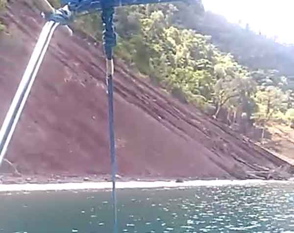
View of the beach of Rakata island in Jan 2019, destroyed by tsunami on 22 Dec 2018 (image: Black / VolcanoDiscovery)
The northern coast of Rakata Island, facing Anak Krakatau, was hit by massive waves (up to approx 30 m high) during the catastrophic landslide and tsunami on the evening of 22 Dec.
The entire beach and the slightly higher, up to 50 m wide forested platform behind it, separating it from the cliff, have been washed away and/or collapsed in landslides following the receding wave.
Surviving fishermen who were in the caldera at the time of the event reported seeing massive waves sweeping over the entire, lower island of Sertung (west of Anak Krakatau), estimating them to be about 25 m in height.
Video was taken by a friend and local guide Black from Carita who also confirmed that the forest and beach of Anak Krakatau are gone as well...
Reconstruction of recent events: collapse, tsunami and regrowth of the Anak Krakatau island
Update Thu 03 Jan 2019 09:30
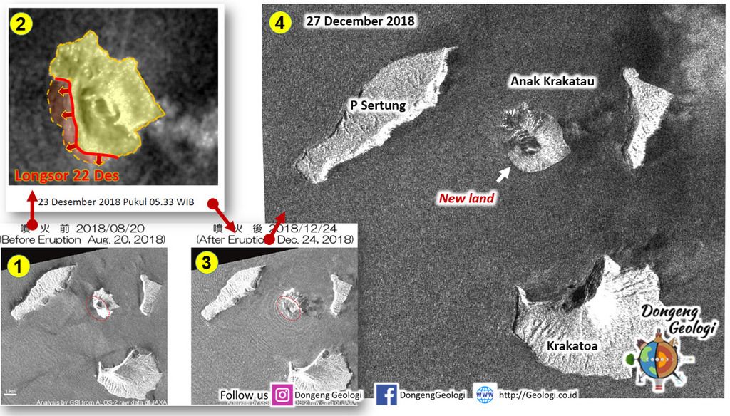
Interpretation of the recent changes on Anak Krakatau by comparing several satellite images (source: Dongeng Geologi)
The attached image compares several detailed satellite images taken before, immediately after the tsunami on 22 Dec 2018 as well two and five days later, and gives an interpretation of what caused the tsunami (= a collapse of the western lava benches).
Comparing the morphology of the island as seen on the pictures, a plausible reconstruction of events would be as follows:
22 Dec: part of the lava flow terrace that forms the western shores of Anak Krakatau collapse, probably involving a significant underwater volume. This caused the tsunami that hit the Java west coast around 21:30 local time.
23-24 Dec: additional collapses (but involving much less volume each) in combination with violent explosions remove more material from the island, eating away until the whole summit cone is gone (3rd picture).
25 Dec: heavy and very wet water-lava explosions deposit meters of fresh, wet ash and blocks all over the island, along with sea current that wash the muddy material to shores. This way, the crescent-shaped island seen on the 27 Dec (and later) pictures with the open crater bay is formed. Significant land addition has extended the island's eastern shores (compare the satellite overlay image posted earlier).
Radial erosion gullies formed quickly as result of torrents of water carving down the loose material now covering the island. This water is both from a) heavy rains as well as b) ejected liquid and b) condensation of steam from the water-rich explosions.
Source:
Teka Teki Gunung Anak Krakatau (Dongeng Geologi)
Krakatoa volcano (Sunda Strait, Indonesia): extraordinary footage showing intense explosions of water with lava
mer., 2 janv. 2019, 21:56 21:56 PM | AUTEUR : T
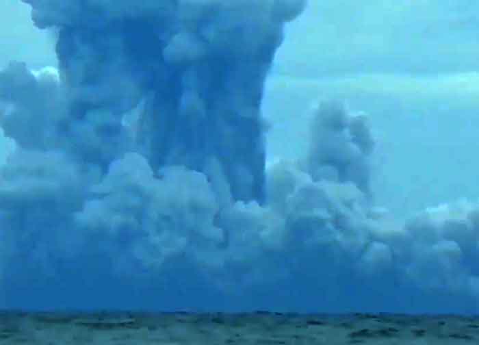
Surtseyan explosion at Anak Krakatau yesterday (image: Doni Janskulo)
Here are some of the most terrifying explosions on Anak Krakatau recently filmed. Our correspondent Doni Janskulo from Kalianda, Lampung, took advantage of very clear views yesterday and managed to take some of the most extraordinary and dramatic footage yet of the explosions on collapsed Anak Krakatau island.
Even though it is from 40 km away, it shows the activity in amazing detail. It takes place at the island of Anak Krakatau, hidden from view now behind Panjang island seen in the foreground. The active vent is now under water and lets sea water interact violently with the rising magma: the result is so-called Surtseyan activity, a type of volcanic eruption that takes place in shallow seas or lakes, named after the island of Surtsey which appeared off the southern coast of Iceland and had this activity in 1963.
In this video, very powerful explosions can be seen generating jets of ash, debris, steam and water to several hundred meters ("rooster tails") radially from the explosion point.
In addition, large surges (horizontally expanding hot clouds of steam mixed with ash) can be seen sometimes engulfing the whole island of Panjang, which is hiding the view of Anak Krakatau itself.
Be sure to watch to the end, at times, the explosions tend to be bigger and bigger throughout the video.
The video was generously granted for display here by local resident and videographer Doni Janskulo, who lost most of his equipment during the 22 Dec 2018 tsunami that devastated Java's west coast.
If you want to support him,
subscribe to his youtube channel or embed this video.
---
Source:
Krakatoa volcano (Sunda Strait, Indonesia): ash plume reported to 35-40,000 ft altitude
mer., 2 janv. 2019, 10:22 10:22 AM | AUTEUR : T
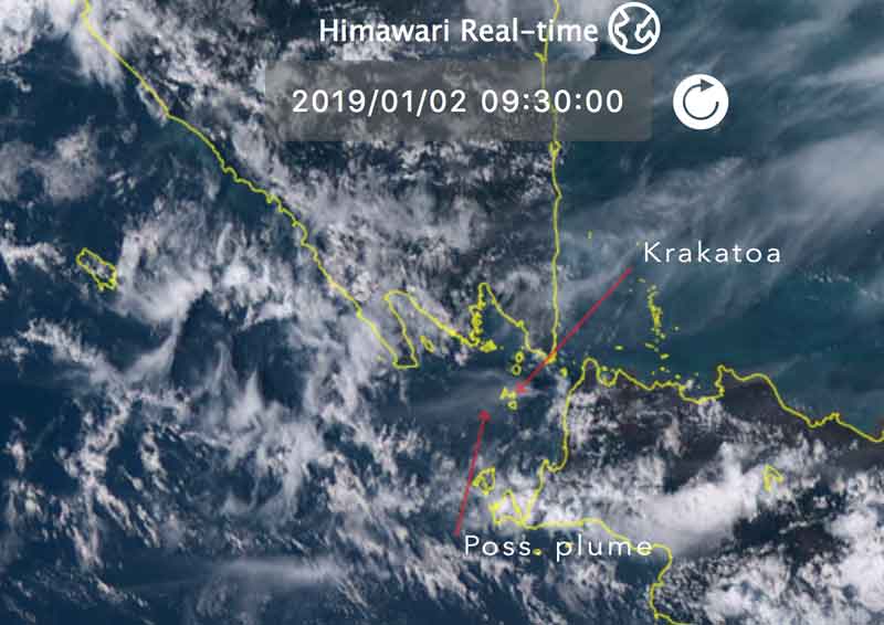
Krakatoa volcano and a possible steam/ash plume this morning on Himawari-8 satellite image

Recent seismic activity as reported by the volcano observatory
Sometimes strong explosive activity seems to continue at the volcano: VAAC Darwin reported an ash plume that rose to 40,000 ft (12 km) altitude this morning as well as "regular, intermittent" emissions of volcanic ash to 35,000 ft (10 km).
Seismic activity is still relatively low, but has picked up again after a phase of near absence at the end of 2018.
Krakatoa volcano (Sunda Strait, Indonesia): fresh aerial image showing the island's dramatic change in shape
lun., 31 déc. 2018, 15:34 15:34 PM | AUTEUR : T

Anak Krakatau island seen 30 Dec 2018 (author unknown / Dongeng Geologi via facebook)

Anak Krakatau island seen 30 Dec 2018 (author unknown / Dongeng Geologi via instagram)
A fresh aerial image from Anak Krakatau has appeared on the very active
Volcanoes and Volcanism group on facebook:
it shows in more detail what the
29 Dec satellite image already confirmed: the island of Anak Krakatau has now the shape of a 270 deg almost closed crescent, with a water-filled crater in the center where once the 330 m tall summit cone stood (which collapsed on 22 Dec causing the tsunami).
Although the image is not detailed enough, it seems (and it would be expected so after the violent phreatomagmatic activity following the collapse) that virtually all of the island has been covered and reshaped, smoothed out by fresh pyroclastic deposits. What if any of its flora and fauna has survived needs to be found out yet by visiting it.
Happy New Year to all!
update:This processed satellite image from 28 Dec below shows the change in morphology even clearer, but includes a significant land gain after the collapse as well, which seems to have build most of the southern "arm" of the crescent. Most of the new land is probably due to accumulated material (tephra) from the intense sursteyan activity in the days after the landslide, building a new large tuff ring around the crater:
We would like to show you embedded content from X/Twitter. If you like to see this content, please make sure you agree with the
privacy policy of X/Twitter and click the button:
View embedded content from X/Twitter---
Source:
Krakatoa volcano (Sunda Strait, Indonesia): new satellite imagery reveal both rapid land loss and growth of Anak Krakatau in detail
dim., 30 déc. 2018, 21:13 21:13 PM | AUTEUR : T
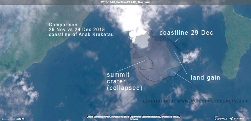
Comparison of Anak Krakatau's coast line seen on 29 Dec with a satellite image before the eruption (26 Nov 2018) (image: Sentinel-2 / ESA)

Satellite image of Anak Krakatau on 29 Dec 2018 (image: Sentinel-2 / ESA)
A new high-resolution satellite image taken yesterday allows an update on the dramatic effects the 22 Dec collapse has had on Anak Krakatau island:
It shows that actually not all, but most of the summit cone is now missing as well as significant parts of the western and southern shores previously formed by young lava deltas. On the other side, there has been a significant enlargement of the coast on the eastern shore.
This poses several big questions (we cannot answer at this point):
1) How much of the enlargement of the coast occurred by debris flows from the collapse(s) itself (if any traveled towards the east and not only SW down into the sea); and
2) how much of it might have been added by a) the violent explosive activity during the following days, and/or b) how much of it can be attributed to sea currents washing loose material deposited into the sea back to shore ?
The latter is likely to be significant, as the coasts in the eastern parts of Anak Krakatau are very shallow, and large amounts of mud can be seen floating around Anak Krakatau in the satellit image.
3) Another question is how large was the collapse that actually led to the generation of the tsunami? Was it only one? - did the summit cone collapse in one go, or did several collapses occur? The latter idea might explain that there were two tsunami waves observed, the first being relatively small, the second one following after a few minutes (but not immediately) and much higher.
At the moment, as mentioned, we can not give answers. But at least some of them could be given by doing more research and, first of all, by detailed ground observations. We hope our team on location around our expedition leader Andi will be soon able to visit the island from close and bring us more information.
We would like to show you embedded content from X/Twitter. If you like to see this content, please make sure you agree with the
privacy policy of X/Twitter and click the button:
View embedded content from X/TwitterKrakatoa volcano (Sunda Strait, Indonesia): first estimates on the effect of the tsunami-triggering landslide
sam., 29 déc. 2018, 10:09 10:09 AM | AUTEUR : T
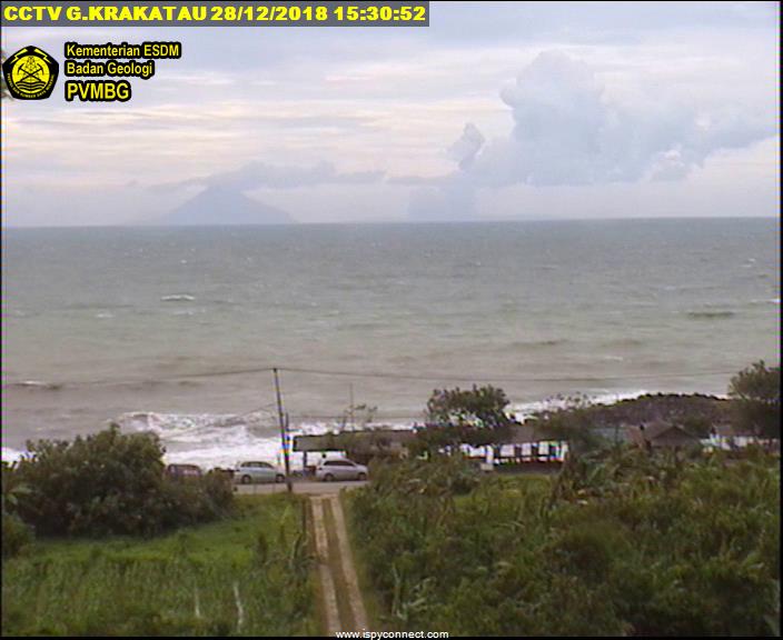
Krakatoa seen yesterday from the coast - Anak Krakatau is no longer visible, only small ash and steam plumes rising from behind Sertung (image: VSI webcam)

Seismicity of Krakatoa during the past weeks (image: VSI)
The activity at the volcano continues at reduced rate. Steam explosions have been more intermittent and smaller during the past 2 days, generating plumes that rose a few hundred meters only.
This trend corresponds to the seismic signals showing a marked decrease since the surge of supply of magma that led to the paroxysm during 21-22 Dec, which accumulated lots of new lava. This in turn might have been "the last straw that breaks the camel's back", i.e. the additional sudden weight on the slopes and/or the shaking induced by the continuous explosions could might have been the final trigger for the landslide to occur.
The Indonesian Center for Volcanology and Geological Disaster Mitigation (PVMBG) published a first official estimate on the effects of the landslide:
- The summit of Anak Krakatau originally 338 meters high is now reduced to only 110 meters, i.e. most of the summit cone has indeed disappeared.
- As a consequence, Anak Krakatau island is no longer visible from the mainland, as the island of Panjang (Long Island) blocks the view from Java's west coast.
- The volume of the collapse is estimated to be between 150-180 million m3, while the remaining volume is currently estimated at between 40-70 million m3.
- For this reason, unless tectonic faults in the area of the Sunda Strait are activated, the risk of other massive landslides and tsunamis is currently deemed to be low.
What's next?However, it is likely that the current eruption continues and is only in a phase of low activity currently; if the cyclic pattern of increased supply every few weeks continues, another phase of stronger activity during January would not be surprising.
---
Source:
Krakatoa volcano (Sunda Strait, Indonesia) activity update: Major eruption ends
ven., 28 déc. 2018, 16:12 16:12 PM | AUTEUR : MJFLEGEND
After almost 6 days of an almost non-stop ash plume to 55,000ft following the devastating collapse, Darwin VAAC reports that activity has finally subsided with only very minor emissions. No updates about local conditions at the moment.
Krakatoa volcano (Sunda Strait, Indonesia): strong explosive activity continues as sea water meets lava
jeu., 27 déc. 2018, 12:40 12:40 PM | AUTEUR : T

Krakatau with steam explosions seen yesterday (image: Sutopo Purwo Nugroho @Sutopo_PN / twitter)

Recent seismic activity showing a rhythmic pattern of peaks in activity every 2-4 weeks (image: VSI)
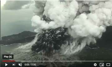
The violent explosive activity caused by magma-water interaction continues at the volcano, from the area where the summit cone collapsed on 22 Dec and now exposes the vent to sea water.
A
video of an overflight earlier today shows powerful steam explosions of this so-called Surtseyan activity, generating dense steam and ash clouds, often ejected as "fingers" of larger ejected rock fragments with training steam behind, as well as billowing surges that shoot horizontally above the water.
Civil Protection (BNPB) raised the alert level of the volcano from Waspada (Level II) to Siaga (Level III) on the Indonesian 1-4 scale and the exclusion zone was extended from 2 to 5 kilometers around the volcano, where people are prohibited from carrying out activities.
We would like to show you embedded content from X/Twitter. If you like to see this content, please make sure you agree with the
privacy policy of X/Twitter and click the button:
View embedded content from X/TwitterSeismic activity from the volcano has been lower following the paroxysm on 21-22 Dec, following the pattern of phases of increased activity roughly every 3-4 weeks, suggesting that magma supply to the vent is currently reduced.
---
Source:
Krakatoa volcano (Sunda Strait, Indonesia): scientists had explained and warned about the tsunami risk 6 years earlier - prediction came true
mar., 25 déc. 2018, 11:58 11:58 AM | AUTEUR : T

Exaggerated cross section and bathymetry of the Krakatau caldera, showing the flank collapse modeled in 2012 (image: Giachetti et al, 2012)
Screenshot from the video from 23 Dec 2018 showing the fresh scar of the flank collapse behind the explosion plumes in the center image left and right (image: Adam Sidiq/Kumparan / youtube)

Comparision of the Krakatau between 2007 and 2018 Oct - before the 22 Dec landslide, the growth of Anak Krakatau to the SW was even more pronounced

Model of the propapagion of the tsunami wave (image: Giachetti et al, 2012)
Sometimes, science has already answers for tragic events, but their voice is not heard or underestimated at the time. The Indonesia tsunami disaster two days ago is such an example: What happened on 22 Dec 2018 had actually already been described and warned about for years in amazing detail:
In January 2012, scientist around volcanologist Dr Thomas Giachetti from the University of Oregon published results of numerical modelling simulating a flank collapse and associated tsunami at Anak Krakatau island and warned about the devastating effects it would have on nearby coasts:
In their paper adequately called "
Tsunami hazard related to a flank collapse of Anak Krakatau Volcano, Sunda Strait, Indonesia", they "numerically simulate a sudden southwestwards destabilization of a large part of the Anak Krakatau Volcano, and the subsequent tsunami formation and propagation."
Anak Krakatau island - the intra-caldera complex called "Child of Krakatau" - has been growing rapidly growing since it first breached the surface of the sea in 1928. Since then, in less than 100 years, it built an overlapping cone during several eruptions, the latest being the one that started May 2018 and still continues. What makes the island particularly prone to gravitational flank failure is that it has been constructed close and above a steep submarine slope, the NE margin of the caldera basin left by the massive 1883 eruption.
As a consequence of this underwater topography, combined with strong sea currents, the western slope of Anak Krakatau has developed to be much steeper than the eastern. Giachetti et al. observed that as the volcano continues to grow towards the SW (which it had done particularly well visible during the recent eruption, s. attached image comparing 2007 and 2018), "landslides along its southwestern flank cannot be excluded. Such a landslide would be directed southwestwards into the 1883 caldera and would trigger waves that would propagate into the Sunda Strait, possibly affecting the Indonesian coasts".
The modeled waive heights in various location correspond amazingly well with what had been observed. At Anyer, for example, waves of up to 1.5 meters would arrive in 38 minutes. Inside the caldera, neighboring islands such as Rakata or Sertung would be hit by waves 15-30 meters in height in less than a minute after the event.
Since the local tsunami warning systems in place was built only with earthquakes as trigger in mind, no warning could be given to the people on the beaches. In addition, the flank collapse occurred at night and the resulting large ash plume (which eventually reached about 15 km altitude), and violent steam explosions as result of sudden interaction of water with magma and hot rocks could not be seen by people. When the tsunami waves arrived they caught everyone by surprise.
It should be noted that the report was written 6 years ago. Since then, the new eruption, everything described in there had even become more true: compared to the situation described in 2012, the cone of Anak Krakatau had significantly been enlarged to the SW and grown in height by estimated 30%.
Change in activity styleThe eruption style changed drastically right after the landslide occurred, as it exposed the conduit and the rising magma to the water. As it no longer erupted from the now-gone summit crater, but at or below sea level in the new scar left by the landscape (which can be seen in the video below), violent steam explosions were the result. As seawater interacted with hot exposed rocks and the magma continuing to rise in the conduit, these so-called phreatomagmatic explosions ejected dense jets of steam, debris and ash, and produced a very large plume. Small surges of overheated steam can be seen traveling over the water as well, in the video by Adam Sidiq/Kumparan published on youtube:
As of now, it appears that the activity at the volcano itself has calmed down again, following the pattern since June of phases of increased magma supply occurring rhythmically about once every 4 weeks, followed by quieter phases.
---
Source:
Victim count continues to rise
Update Tue 25 Dec 2018 10:36
According to the latest information from official sources, the toll of the tsunami climbed to at least 429 people killed, 1485 injured, and 154 still missing. Many people among the victims were caught by surprise in their sleep.
At least 882 homes and 73 hotels were damaged or destroyed.
Example of a (small) lateral blast from Krakatoa:
Update Mon 24 Dec 2018 15:46
A version with the start of the explosion filmed in Oct slowed down 10x where you can see how it breaks through the cone itself:
Something like this
might have occurred on Saturday, leading to the partial collapse of the cone.
What caused the tsunami?
Update Mon 24 Dec 2018 14:58
The triggering cause of Saturday's tsunami is still being discussed. A common and likely interpretation is a landslide, which could have been caused by either, or a combination of:
- a slide simply caused by the weight of rapidly accumulated new lava material on the flanks, both above and below water
- a sudden lateral blast caused by an explosion as magma rising could not be released quickly enough from the established summit vent.
It is also unclear how much of the island disappeared by the initial event and how much crumbled away during the following erosion by eruption and adjustments by gravity.
A sketch published on twitter illustrated the version implying a larger lateral blast:
We would like to show you embedded content from X/Twitter. If you like to see this content, please make sure you agree with the
privacy policy of X/Twitter and click the button:
View embedded content from X/TwitterA smaller version - without flank collapse, fortunately (or the video and people involved would not exist any more) - was filmed in Oct by Ronny, one of our participants on the Krakatau Volcano Special tour: (you have to watch carefully where the eruption starts):
Call for donations for victims
Update Mon 24 Dec 2018 10:50

Tsunami damage on Java's west coast (image: Øystein Lund Andersen / facebook)
If you like to send a small donation for the victims of the Dec 2018 tsunami in Java (Indonesia), we are
providing a direct channel to do so: we collect donations through our PayPal account and forward this money direct to our local expedition leader Andi who delivers this money directly to affected people in need through his organization ITGA / HPI.
You can do this through PayPal:
Large part of Anak Krakatau has collapsed into the sea - reconstruction of the eruption
Update Sun 23 Dec 2018 17:18

Steam and ash explosions at Krakatau seen this morning (Image: Dicky Adam Sidiq/kumparan)
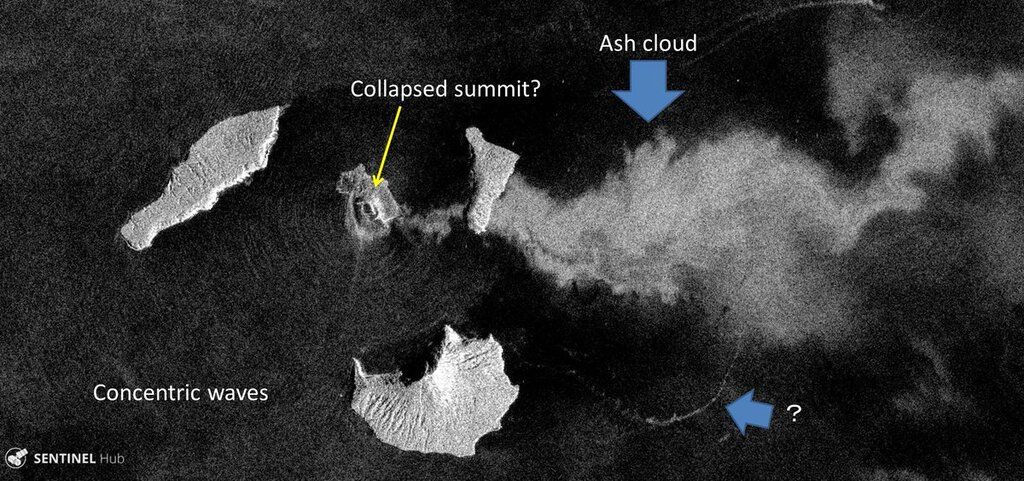
Satellite image taken yesterday after the collapse, possibly showing one of the tsunami waves (image: Sentinel 1, annotations by R. Natsuaki @flyingwktk / twitter)

Comparison of Anak Krakatau before and after the flank collapse (image: Sentinel 1)
Strong activity at Krakatau before the peak of the activity later in the evening, taken on 11:15 local time on 22 Dec by website visitor Gabriela Garcia who kindly submitted a volcano report.
First visual information about the situation on Anak Krakatau island group itself has come in, revealing that a large part of Anak Krakatau's SW flank has collapsed, which most likely is the trigger for last night's tsunami.
An overflight of was undertaken today by the
Kumparan agency and revealed continuous, violent phreatomagmatic explosions, i.e. driven by lava and water interaction.
The combined information allows a rough reconstruction of the events:
#1 A new surge of magma arrives in the upper conduit of Anak Krakatau from around 20-21 Dec, causing increasing explosive and effusive activity - strombolian explosions or lava fountains, and lava flow emission - from the summit vent. It looked more or less like this:
(video from a similar paroxysm in Sep 2018)
A photo submitted by a visitor, taken on 22 Dec at 11:15 shows the advancing lava front close to the southern shore and strong strombolian explosions, which occurred at intervals of 15-30 seconds according to the report. This activity probably reached its peak on the evening of 22 Dec, when it was clearly visible by naked eye from more than 40 km away on the coast.
#2 In the evening of 22 Dec, lava fountains fed flows that reached the sea, probably on the south or southeast shores of Anak Krakatau, in similar locations as during previous episodes this year.
#3 Around 21:00 local time, the weight of rapidly accumulated lava on the subaerial and submerged cone of Anak Krakatau triggered an instability and a larger landslide removed a part of the southwestern cone - a flank collapse occurred. This rapid displacement caused the (small, but devastating) tsunami which reached the Java coast around 21:30 (local time).
#4 As a consequence, sea water gained access to large masses of hot rocks and possibly the conduit itself, triggering an ongoing series of steam explosions that produced the steam and ash plume first observed later this morning on satellite data and seen in this video:
Erosion of material from the ongoing explosive activity and along the new shoreline continues to eat away parts of the island.
What will come next?
This is difficult to say, but at least to a large extent it will depend on how much magma continues to rise, whether new collapses occur and so on. A possibility of even larger explosions, pyroclastic flows, tsunamis is clearly increased.
The alert level of the volcano was raised to red.
At least 222 people dead
Update Sun 23 Dec 2018 11:05
As evening breaks on the west coast, BNPB updated the death toll to at least 222 victims, 843 injured and 28 missing people. Damage along the coast is extensive.
Media worldwide was unaware of disaster for 8 hours
On a side note, it is quite strange to see that it took international media about 8-9 (!) hours before they became aware of this major disaster. The tsunami occurred around 21:30 local time (14:30 GMT), but it was only about 8 hours later, on the next morning (local time) or late evening GMT time that Øystein Lund Andersen posted his eyewitness report, which we picked up first and only then it spread quickly around the world to all channels.
Death toll continues to rise
Update Sun 23 Dec 2018 05:49
Unfortunately, the death toll of the tsunami last night continues to rise. So far, at least 62 fatalities and 584 injured people have been counted by authorities.
Krakatoa volcano (Sunda Strait, Indonesia): possible major eruption with ash to 55,000 ft following deadly tsunami
dim., 23 déc. 2018, 04:13 04:13 AM | AUTEUR : T
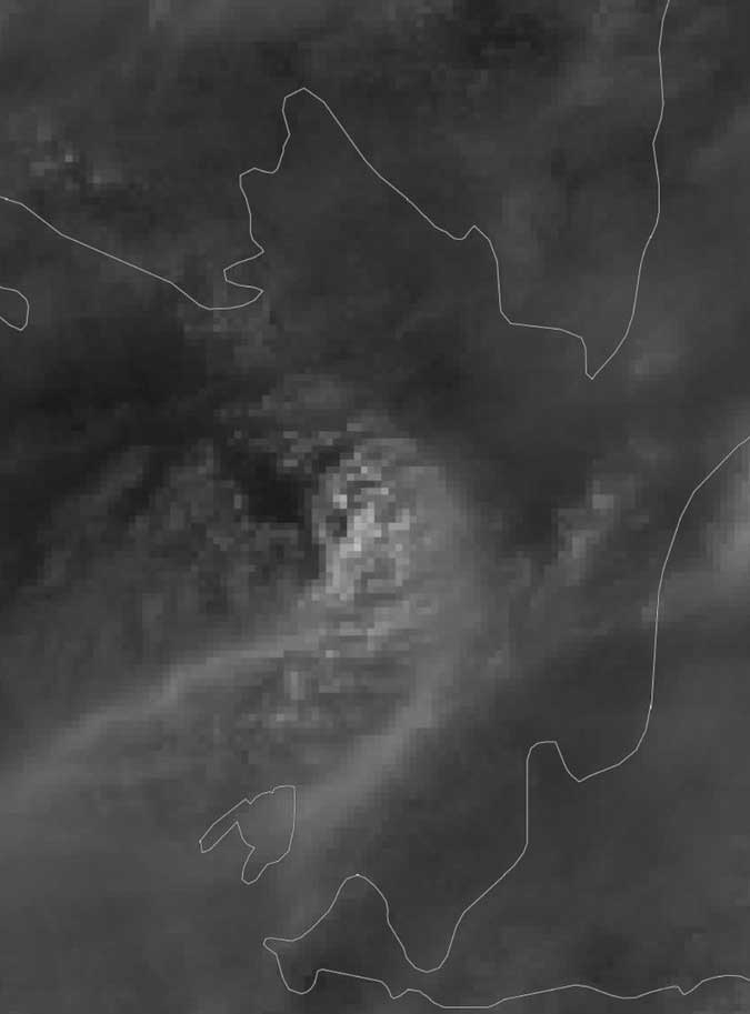
Ash plume from Krakatoa volcano this morning (image: VAAC Darwin)
A major explosive eruption might have occurred at the volcano earlier this morning. VAAC Darwin spotted a large cloud, possibly an ash plume from the eruption reaching approx. 55,000 ft (15 km) altitude and drifting S and SW.
Whether it is is from the eruption still needs to be confirmed, but seems rather likely. What role the
yesterday's deadly tsunami plays here is also still unknown, but they are hardly unrelated.
In the meanwhile, more material is emerging on social channels about the tsunami, such as this dramatic video, showing the arrival of the first wave, destroying a band and its audience playing a concert (at the end of the video):
Krakatoa volcano (Sunda Strait, Indonesia): strong eruptive phase, tsunami hits West Coast of Java
sam., 22 déc. 2018, 22:47 22:47 PM | AUTEUR : T

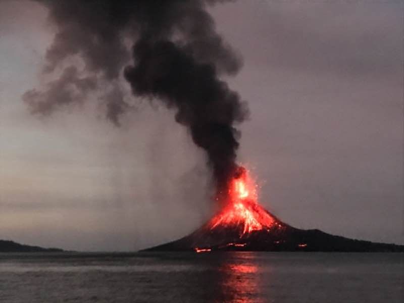
Lava flows entering the sea and lava fountaining from Anak Krakatau this evening (22 Dec 2018; image: Øystein Lund Andersen / facebook)

Tsunami entering the coast of Anyer 22 Dec 2018 (image: Øystein Lund Andersen / facebook)
[Update 4]:
According to the latest information, 43 people died, 584 were injured and two persons are still missing persons from last evening's tsunami on Java's west coast. In addition, 430 houses and 9 hotels were heavily damaged according to information from PNBG.
The current eruptive phase of the volcano seems to be in fact rather strong. A new lava flow is reaching the sea and strong explosive activity, likely pulsating lava fountains are occurring at the summit vent.
Our friend Øystein Lund Andersen reported that a small tsunami, possibly caused by stronger explosions from the volcano, hit the west coast of Java near Anyer, where we was on the evening of 22 Dec observing the volcano. A first wave traveled 15-20 m inland and was followed by another (stronger) one that invaded the street and buildings near the coast. According to his report, it drowned cars, injured and possibly killed an unknown number of people. However, not much other news have reported a major incident, so it might have been not as severe as reported, fortunately.
UPDATE: another possibility is that the waves were unusually strong spring tide waves; there is no official confirmation for a tsunami to have occurred (yet).
2nd UPDATE: more news is slowly emerging. Unfortunately, it seems that indeed the waves were a tsunami and caused at least 20 fatalities, according to BCC, referring to Indonesian governmental sources.
3rd UPDATE:Indonesia's Civil Protection Agency (BNPG) has officially announced that a tsunami has occurred and hit several coastal areas in the Sunda Strait, including on the coast in Pandeglang, Serang, and South Lampung Regencies. The tsunami occurred on 12/22/2018 around 9:27 p.m. WIB.
According to them, the tsunami was not caused by earthquakes (as no tectonic activity was detected), but most likely by an underwater landslide of accumulated sediments giving way. Whether it was caused by the eruption of Krakatoa and where exactly is still unclear. Its size also may have been increased by the influence of the full moon spring tide.
The Geological Agency detected that the start of the current paroxysm of the volcano began at 21:03 WIB local time. It damaged the local seismic station (probably it was hit by lava bombs).
The full impact of the tsunami is still unclear, but preliminary data indicate 20 people died and 165 people were injured; 2 people were missing and dozens of buildings were damaged. Unfortunately, the number of victims is likely to continue to grow considering that it is still night in Indonesia and not all areas have been investigated.
People are encouraged to remain calm and avoid the coast of the Sunda Strait for a while. BMKG and the Geology Agency are still conducting further research.
Below is Øystein's original post:
---
Source:
Krakatoa volcano (Sunda Strait, Indonesia): increased activity, likely new phase of lava fountains and lava flow
sam., 22 déc. 2018, 08:52 08:52 AM | AUTEUR : T
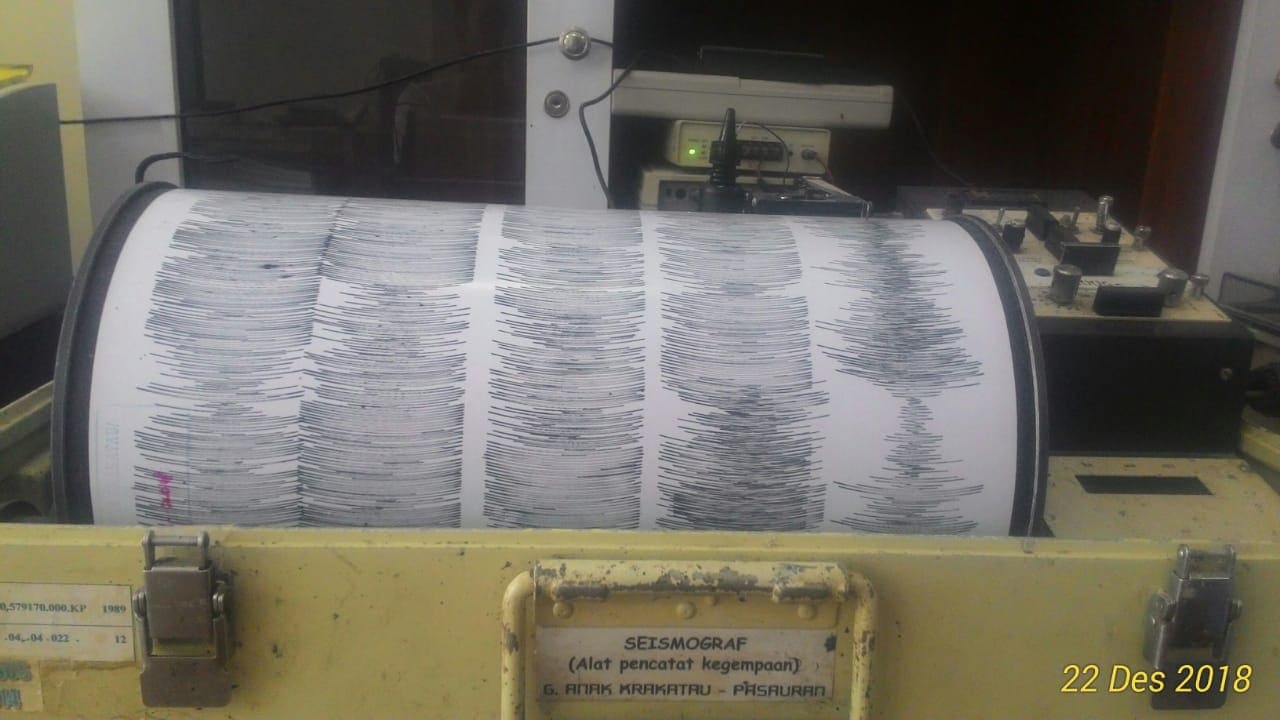
Saturated seismic signal at Krakatau this morning, showing strong tremor and continuous explosions (image: Krakatau volcano observatory via Galih Jati / VolcanoDiscovery)
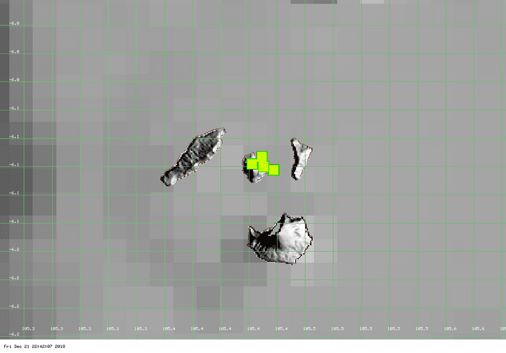
Hot spots at Krakatau suggesting the presence of lava flows and/or abundant hot ejecta (image MODIS / Univ. Hawaii)
Another strong eruptive phase (paroxysm) is currently going on at the volcano.
Seismicity at Anak Krakatau has sharply increased during the past days and now shows continuous explosive/effusive activity. The observatory informed us that a lava flow is occurring from the summit vent, likely accompanied by lava fountaining, similar to what we observed in Sep and Nov during our
latest expeditions to Krakatau.
This is what it probably looks like now:
(eruption in Sep, daytime)
and
(Nov eruption, evening)
First visit to our site? If you havn't done it yet,
download the Volcanoes & Earthquakes app to get one of the fastest volcano news online:
Android |
IOS


