Nemrut Dagi Volcano
Updated: 17 mai 2024 19:51 GMT -
caldera 2948 m
Turquie, 38.62°N / 42.26°E
Condition actuelle: normal / en sommeil (1 sur 5)
Turquie, 38.62°N / 42.26°E
Condition actuelle: normal / en sommeil (1 sur 5)
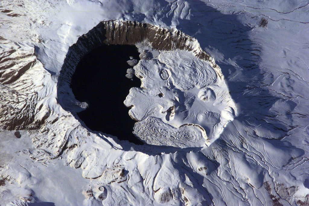
The summit of Nemrut Dagi is truncated by a 5 x 9 km caldera near Lake Van in eastern Turkey. A lake that partially fills the western side of the caldera is constrained by post-caldera eruptions that produced glassy obsidian lava flows from domes on the eastern caldera floor. A series of scoria cones and lava domes were erupted along N-S-trending fissures on the northern flank. Ash layers in Lake Van document numerous Holocene eruptions from Nemrut Dagi. (Image: NASA International Space Station image ISS001-E-6354, 2001, http://eol.jsc.nasa.gov/).
Nemrut Dağ (or Nemrut Dagi) volcano is the westernmost of a group of volcanoes near Lake Van in eastern Anatolia, and the only one that has erupted in historical time. It contains a 9 x 5 km caldera partially filled on its western side by a caldera lake.
[smaller] [larger]
Eruptions du volcan Nemrut Dagi: 1881 AD
1441 AD
Derniers séismes proches
| Heure | Mag. / Profondeur | Distance / Lieu | |||
| 14 mai 21:10 (Istanbul) | 2.6 7 km | 18 km au nord | Info | ||
| 14 mai 10:07 (Istanbul) | 3.2 9.9 km | 29 km au sud-ouest | Info | ||
| jeudi, 9 mai 2024 GMT (1 séisme) | |||||
| 10 mai 02:57 (Istanbul) | 1.4 6.9 km | 8.4 km au nord-ouest | Info | ||
Introduction
The diameter of the caldera is about 9 x 5 km and it is half filled by a crater lake. Volcanic activity after the caldera formation has produced rhyolithic & basaltic lava flows and domes at the caldera rim and on its floor.Pyroclastic flows and the emission of glassy obsidian lava flows accompanied construction of lava domes within the caldera; later activity formed a series of cinder cones and lava domes erupted along N-S-trending fissures on the northern flank. The most recent activity has been concentrated along a NNW-trending fissure cutting the eastern caldera floor and extending beyond the north caldera rim; nearly two dozen cinder cones and lava domes were constructed on the caldera floor. Ash layers in Lake Van document numerous Holocene eruptions, and an historical eruption in 1441 AD from a north-flank fissure involved compositionally bimodal lava flows.
Nemrut Dagi Volcano Photos
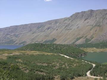
Nemrut Dagi, petite partie du lac bleu et vert, près de Tatvan, Anatolie orientale, Turquie (Photo: WNomad)
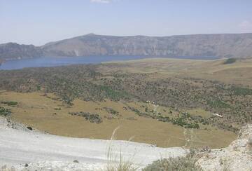
Vue panoramique du lac Bleu dans la caldeira Nemrut Dagi, Turquie (Photo: WNomad)


