Latest Worldwide >  El Salvador > San Vicente
SEARCH
Latest Quakes | Top 20 | Report a Quake! | Damaging Quakes | By Country/Region | Near Me | Quake Stats | FAQ | News | Volcanoes | Be Safe


SEARCH
| Latest See all | Mag. 2.7 earthquake North Pacific Ocean - La Libertad, El Salvador - |
| Strongest past 7 days | Mag. 4.4 North Pacific Ocean - San Salvador, El Salvador - May 13, 2024 - |
Date and Time | Mag Depth | Nearest Volcano | Location | Details | Map |
|---|---|---|---|---|---|
| May 20, 02:58 am (GMT -6) | 2.7 34 km | 79 km (49 mi) to the SW | Info | ||
| May 20, 02:25 am (El Salvador) | 1.6 5 km | 59 km (37 mi) to the NW | Info | ||
| May 20, 02:25 am (GMT -6) | 2.4 3 km | 93 km (58 mi) to the S | Info | ||
| May 20, 01:10 am (GMT -6) | 2.6 23 km | 84 km (52 mi) to the SW | Info | ||
| Sunday, May 19, 2024 GMT (6 quakes) | |||||
| May 19, 04:40 pm (GMT -6) | 3.1 36 km | 92 km (57 mi) to the SW | Info | ||
| May 19, 03:23 am (GMT -6) | 2.5 27 km | 94 km (58 mi) to the S | Info | ||
| May 19, 03:19 am (GMT -6) | 2.6 5 km | 99 km (62 mi) to the SW | Info | ||
| May 19, 03:19 am (GMT -6) | 2.4 38 km | 70 km (44 mi) to the SW | Info | ||
| May 19, 12:24 am (El Salvador) | 2.1 12 km | 46 km (29 mi) to the NW | Info | ||
| May 19, 12:23 am (El Salvador) | 2.7 197 km | 40 km (25 mi) to the SW | Info | ||
| Saturday, May 18, 2024 GMT (3 quakes) | |||||
| May 18, 11:46 am (GMT -6) | 3.2 16 km | 88 km (54 mi) to the S | Info | ||
| or | ||
Look up quakes! | ||
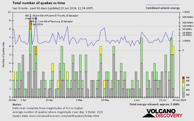
San Vicente has a very high level of seismic activity. Based on data from the past 14 years and our earthquake archive back to 1900, there are about 526 quakes on average per year in or near San Vicente, El Salvador. San Vicente has had at least 3 quakes above magnitude 7 since 1900, which suggests that larger earthquakes of this size occur infrequently, probably on average approximately every 40 to 45 years.
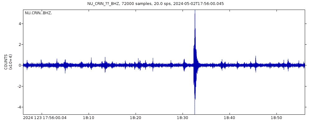
The last earthquake in San Vicente occurred 13 minutes ago and had a magnitude of 2.7:
A light magnitude 2.7 earthquake occurred in the North Pacific Ocean near the coast of ![]() El Salvador in the early morning of Monday, May 20, 2024 at 2.58 am local time (GMT -6). The quake had a very shallow depth of 34 km (21 mi) and was not felt (or at least not reported so).
El Salvador in the early morning of Monday, May 20, 2024 at 2.58 am local time (GMT -6). The quake had a very shallow depth of 34 km (21 mi) and was not felt (or at least not reported so).
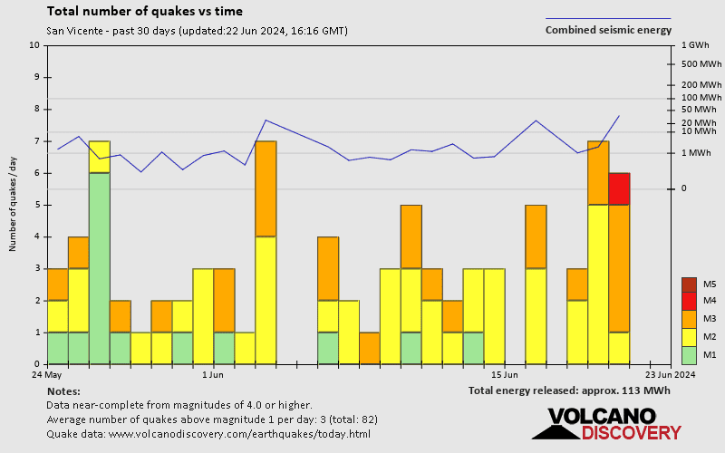
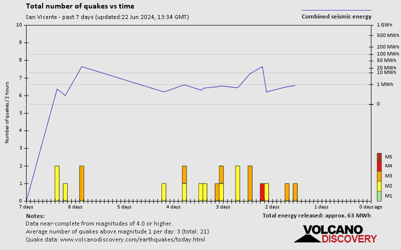
In the past 7 days, San Vicente was shaken by 1 quake of magnitude 4.4, 5 quakes between 3.0 and 4.0, and 14 quakes between 2.0 and 3.0. There were also 4 quakes below magnitude 2.0 which people don't normally feel.
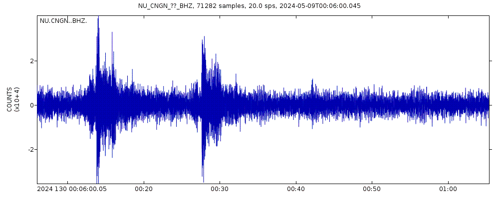
The strongest earthquake in San Vicente in the past 7 days had a magnitude of 4.4 and occurred 6 days ago:
A moderate magnitude 4.4 earthquake occurred in the North Pacific Ocean near the coast of ![]() El Salvador late in the evening of Monday, May 13, 2024 at 11.20 pm local time (GMT -6). The quake had a very shallow depth of 29 km (18 mi) and was felt by many near the epicenter.
El Salvador late in the evening of Monday, May 13, 2024 at 11.20 pm local time (GMT -6). The quake had a very shallow depth of 29 km (18 mi) and was felt by many near the epicenter.
Date and Time | Mag Depth | ###DIST_LABEL### | Location | Details | Map |
|---|