Kontakt | RSS | EN | DE | EL | ES | FR | IT | RU

Barren Island Volcano

Updated: 21. Mai 2024 20:28 GMT -
Stratovolcano 354 m / 1,161 ft.
Indian Ocean, 12.28°N / 93.86°E
Aktueller Status: Ausbruch (4 von 5)
Last update: 10 Apr 2024 (Smithsonian / USGS Weekly Volcanic Activity Report)
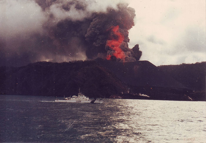
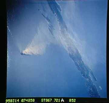
Eruption of Barren Island volcano in 1994

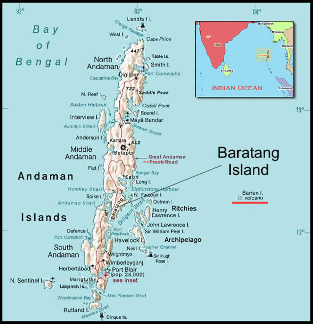
Barren Island, a possession of India in the Andaman Sea about 135 km NE of Port Blair in the Andaman Islands, is the only historically active volcano along the N-S-trending volcanic arc extending between Sumatra and Burma (Myanmar). The 354-m-high island is the emergent summit of a volcano that rises from a depth of about 2250 m.

[smaller] [larger]
Typische Aktivität: Explosive
Ausbrüche des Barren Island: 1787, 1789, 1795, 1803-04, 1852(?), 1991, 1994-95, 2005-2006, 2015, 2016, 2018, 2019

Letzte Erdbeben in der Nähe

No recent earthquakes
UhrzeitMag. / TiefeEntfernung / Ort

Beschreibung

The small, uninhabited 3-km-wide island contains a roughly 2-km-wide caldera with walls 250-350 m high. The caldera, which is open to the sea on the west, was created during a major explosive eruption in the late Pleistocene that produced pyroclastic-flow and -surge deposits. The morphology of a fresh pyroclastic cone that was constructed in the center of the caldera has varied during the course of historical eruptions. Lava flows fill much of the caldera floor and have reached the sea along the western coast during eruptions in the 19th century and more recently in 1991 and 1995.

---
Source: GVP, Smithsonian Institution

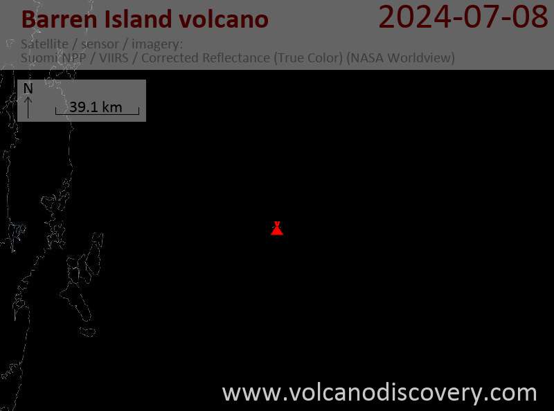
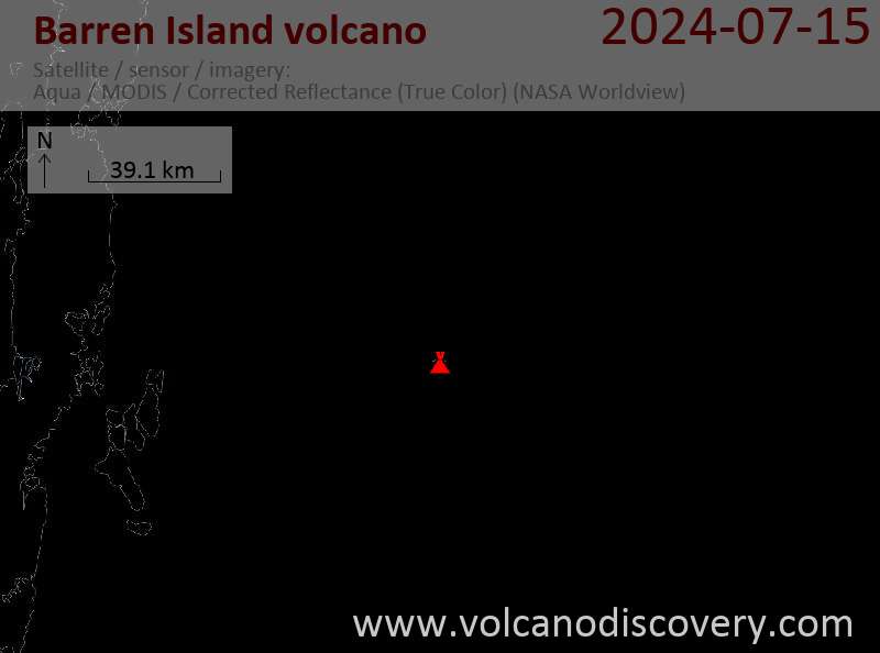
Latest satellite images

barrenisland satellite image sat1barrenisland satellite image sat2
Die Aschenwolke vom Ausbruch des Barren Island Vulkans, aufgenommen vom NASA Space Shuttle am 14. März 1995.

Kommentar zum Photo: In schrägem Blickwinkel aufgenommen ist eine große Aschenwolke des Barren Island Vulkans beim Ausbruch vom März 1995 zu sehen. Die Aschenwolke driftet nach Westen in Richtung auf die Hauptinseln der Andaman Gruppe zu, zu denen auch Barren Island gehört. Aus dem Photo lässt sich erkennen, dass es wahrscheinlich drei verschiedene Luftströmungen in der Atmosphäre gibt, die die jeweiligen Teile der Aschenwolke jeweils in unterschiedliche Richtungen verdriften lassen: die erste, unterste Schicht in Bodennähe bewegt sich nach Südwesten (nach oben links im Bild). Die beiden anderen Lagen liegen höher und lassen zunächst eine kräftige nach Westen treibende Strömung (nach rechts im Bild) erkennen, die von einer weniger dicht scheinenden und auch anders zusammengesetzten Aschenströmung nach West-Südwest (oben rechts) überlagert zu sein scheint.


Mi, 10. Apr 2024, 14:00

Barren Island volcano (Andaman Islands, India) - Smithsonian / USGS Weekly Volcanic Activity Report for 3 April-9 April 2024 (New Activity / Unrest)

Eruptive activity at Barren Island continued according to notices from the Darwin VAAC. Ash plumes identified in satellite images during 2-3 April rose 0.9-1.5 km (3,000-5,000 ft) a.s.l. and drifted SW and W. ... Read all
Mi, 3. Apr 2024, 18:00

Barren Island volcano (Andaman Islands, India) - Smithsonian / USGS Weekly Volcanic Activity Report for 27 March-2 April 2024 (New Activity / Unrest)

According to the Darwin VAAC eruptive activity at Barren Island produced ash plumes during 28 March-1 April. Ash plumes identified in satellite images at 1320 and 1930 on 28 March rose to 2.4 km (8,000 ft) a.s.l. and drifted NW. ... Read all
Location map of the Andaman Islands.
Map of the Andaman Islands with the location of Barren Island.

Auf dieser Seite:

Warum gibt es Werbung auf dieser Seite?
Sources: VolcanoDiscovery / VolcanoAdventures and other sources as noted.
Use of material: Most text and images on our websites are owned by us. Re-use is generally not permitted without authorization. Contact us for licensing rights.
Volcanoes & Earthquakes
VolcanoDiscovery Home
Vulkane | Erdbeben | Fotos | News | App
Adventure & Study Travel
Reisen zu Vulkanen und Vulkangebieten: Wanderreisen, Studienreisen, Fotoreisen
Tours & Dates | FAQ | About us
Get our newsletter!
Company info
Kontakt | Impressum | AGB
Follow us
Follow us on facebook Follow us on Instagram Follow us on Twitter Visit our Youtube channel
EN | DE | EL | ES | FR | IT | RU
VolcanoDiscovery GmbH, Germany, Reg. nr.: HRB 103744, EU Tax Id: DE 297 465 123 owned and created by
Dr. Tom Pfeiffer, volcanologist, volcano photographer, tour organizer member of
IAVCEI
IAVCEI
Vulkanologische Gesellschaft
Volcanological Society
Ecotourism Greece
Ecotourism Greece
RUV insurance
Insured by R+V
VolcanoDiscovery © 2004- All Rights Reserved | Datenschutz - Cookie Einstellungen
Cookie-free, privacy-friendly web stats